Dry Pattern Central Europe to Black Sea Region Continues as Drought Worsens
03/14/2025, 3:45 pm EDT
Drought Expansion Likely in Europe to the Black Sea Region for the 2025 Warm Season
03/18/2025, 4:21 am EDT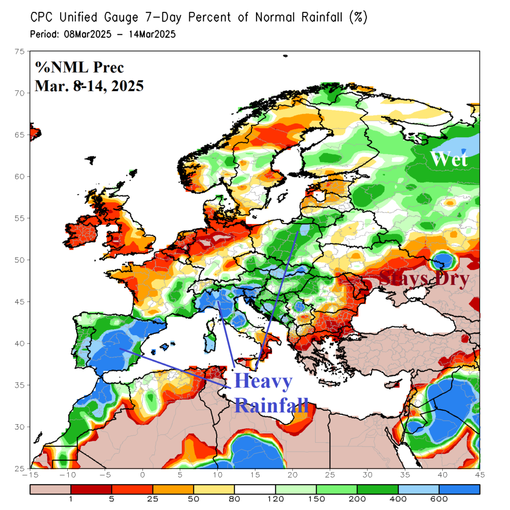

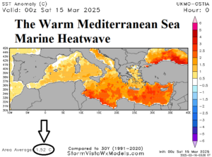
Fig. 1-2: March 8-14, 2025, percent of normal precipitation across Europe and the daily SSTA analysis across the Mediterranean Sea.
Discussion: A streak of heavy rain causing flooding from Southwest Europe extending to Northern Italy and farther northeast reaching Poland developed the past couple days (Fig. 1). Wet weather also expands across Northwest Russia. The Black Sea region has remained dry (for now). The heavy rainfall is enhanced by the increased amount of low-level moisture in the atmosphere caused by the long-standing marine heatwave (MHW) stretched across the Mediterranean Sea (Fig. 2). ECMWF short-term forecasts indicate some of the rain will reach the Black Sea region through the first half of this week (Fig. 3). Heavy rain will continue across Southwest Europe much of this week. After a dry 6-10-day period in the Black Sea region, some forecast models, including ECMWF return rainfall risk to the Black Sea region in the 11-15-day period (Fig. 4). The MHW in the Mediterranean Sea and off the west and southwest coast of Europe propelled a drought-inducing high-pressure ridge during meteorological winter affecting East Europe, Southwest Russia, and the Black Sea region (Fig. 5-6). However, when synoptic scale storms come along, the warmer than normal SSTA patterns fuel over-achieving precipitation events. The regime is an example of modern-day climatology where long-standing generally dry regimes associated with warmer than normal oceans are interrupted by brief extreme precipitation events fueled by the warm waters.
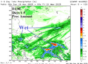
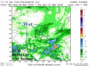
Fig. 3-4: ECMWF MAXRES precipitation amount forecast for the Black Sea region in the 15-day and 11-15-day periods.

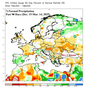
Fig. 5-6: The DEC/JAN/FEB 2024-25 upper-level high pressure over Europe and the attendant 90-day dry climate across East Europe/Southwest Russia.