Ongoing Southeast Australia Bushfires Receive Some Short-term (Only) Minor (Rain) Relief
01/05/2025, 4:08 pm EST
Dramatic Cooling East Pacific Subsurface in December; La Nina Lasts to Q2/2025
01/09/2025, 2:09 pm EST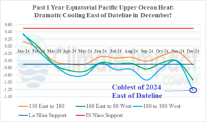
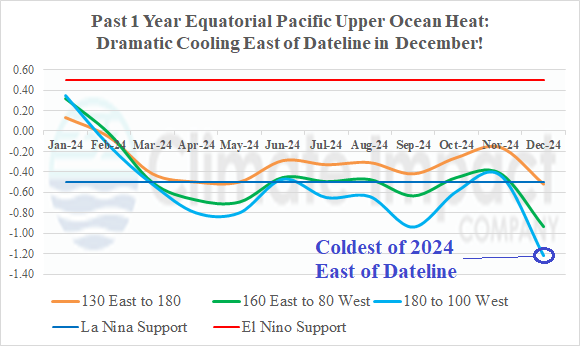
Fig. 1: Upper ocean heat in the equatorial Pacific to the east of Dateline is the strongest observed in December for all of 2024.
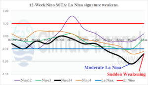
Fig. 2: The 12-week monitoring of the Nino SSTA regions.
Discussion: During DEC-24, the equatorial Pacific Ocean to the east of the Dateline produced a sharp drop in upper ocean heat (Fig. 1). The observation is by far the coolest of 2024, a year when La Nina has struggled to develop. The dramatic subsurface cooling coupled with increased trade winds helped the Nino34 SSTA surge to a moderate-strength La Nina-like value of -1.1C Christmas Week (Fig. 2).
The southern oscillation index (SOI) shifted negative during late DEC/early JAN and trade winds eased allowing Nino34 SSTA to warm dramatically last week although still within the La Nina threshold. Clearly, the eastern equatorial Pacific Ocean surface and subsurface temperature anomaly pattern is very sensitive to the Madden Julian oscillation (MJO) location. The MJO is forecast to shift eastward toward the tropical Atlantic over the next couple weeks. Forecast models indicate -SOI/weaker trade winds for the next 2 weeks which would continue to weaken the newborn La Nina episode. However, if MJO shifts to phase_1/phase_2 as indicated by most models, +SOI should regenerate allowing La Nina to regain strength. An extremely volatile and sensitive ENSO phase regime (and forecast)!
Global models vary on the ENSO outlook as ECM weakens La Nina by May 2025 (Fig. 3) while CFS V2 maintains cold ENSO (Fig. 4). Given the disagreement, forecast confidence of ENSO phase by May is low. Note the large marine heat waves (MHW) particularly in the northern hemisphere, regaining strength for next summer.
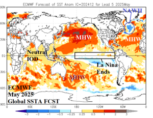
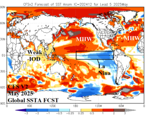
Fig. 3-4: The ECMWF and CFS V2 global SSTA forecast for May 2025.

