Regional SSTA Patterns Bring Surprising Climate Regimes
12/16/2024, 4:43 am EST
Dealing With Cold Weather After Holiday Season in U.S.
12/24/2024, 9:47 am EST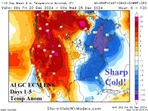
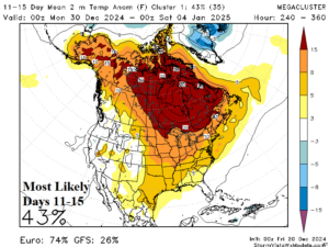
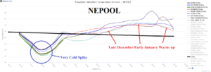
Fig. 1-3: AI GC ECM ENS 1-5-day U.S. temperature anomaly forecast, the “most likely” 11-15-day U.S. temperature anomaly pattern, and 15-day NEPOOL gas population weight temperature forecast.
Discussion: Natural gas prices have risen significantly this week due to incoming cold affecting the East U.S. this weekend into early next week particularly the Northeast U.S. (Fig. 1). The natural gas price rise with a warm 11-15-day forecast is rare (Fig. 2). The hardest hit by cold areas includes PJM-East and particularly NEPOOL (Fig. 3). The cold peak is on Sunday (Boston 22/10) when the ground should have a thin coating of snow to enhance the cold.
The next cold temperature issue arises in the week-3 forecast when all “weeklies” models project an evolving upper trough in the East U.S. (Fig. 4-7). ECM continues with the strongest trough forecast. For the moment, arctic air is not anticipated with this upper trough. Ahead of the trough, the weather pattern is warm and snow cover retreats to Canada. Consequently, the initial cold may not be impressive. If the trough lingers into the following week (expected), the air mass could be colder. Climate models/analogs do not have this upper trough, and despite January being only 11 days away, the January U.S. temperature forecast is uncertain.
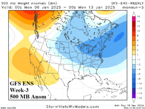
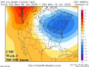
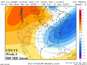
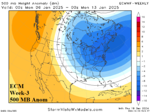
Fig. 4-7: The “weeklies” forecast models all have an upper trough in the East U.S. in 3 weeks.
Additional short-term issues include an “atmospheric river” storm track into the West Coast and Southwest Canada during the next 7-10 days (Fig. 8). Several to >10 inches of rain are expected, most focused on northwest California. Several feet (at least) of snow is expected in mountain areas.
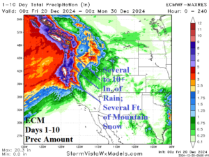
Fig. 8: The ECM 10-day precipitation amount forecast for the West Coast.
The U.S. gas population weight HDD forecast illustrates the volatility of the pattern. Utilizing all models, the consensus HDD forecast for the U.S. is near normal national heating demand (despite the East cold) for Dec. 20-26 dropping dramatically as December ends near record warm (Fig. 9). Colder and near normal national demand generates Jan. 3-9. The CFS V2 week 4-6 HDD outlook indicates evolution of a higher than normal heating demand regime in the U.S. for mid-to-late January inspired by the implied East U.S. chill (Fig. 10).

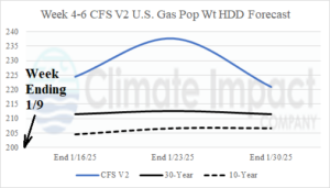
Fig. 9-10: The U.S. gas population weight HDD forecast through early January utilizing all operational models and the CFS V2 week 4-6 forecast.

