Late Season Heat for U.S. Corn; Drought-ridden Southern Brazil Sugarcane Receives Wetter Forecast
09/12/2024, 5:04 am EDTCurrent Heavy Rain Episode Shifts South, More Rain Mostly Northern Half of Europe Late September
09/16/2024, 4:32 am EDTHighlight: Australia chill.
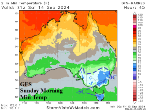
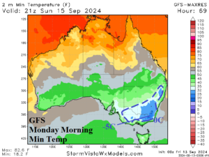
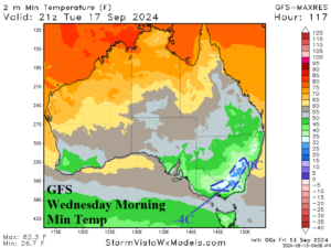
Fig. 1-3: GFS identifies <32F/0C episodes in Southeast Australia Sunday, Monday, and Wednesday morning.
Discussion: Small but potent upper trough brings an unusually chilly air mass to Southeast Australia on Sunday producing exceptional cold mornings on Sunday and Monday. GFS indicates <32F/0C risk into North-central New South Wales Sunday morning with -5C across the interior southeast including northeastern Victoria (Fig. 1). On Monday morning, the cold regenerates and extends northward to near the Queensland/New South Wales border just inland from the coast (Fig. 2). The cold lingers Tuesday and Wednesday morning, coldest on Wednesday although moderated (Fig. 3). Trailing the upper trough is an amplified ridge south of Australia producing a 1040 MB high pressure system which forces the Southeast Australia chill.