Using AIFS, Beneficial Rain Southern Brazil Sugarcane Areas Ahead
09/11/2024, 11:03 am EDTPotential Tropical Cyclone 8 Moves Inland This Evening
09/16/2024, 5:43 am EDTChart of the day: Emerging wet pattern in the Mid-Atlantic States.
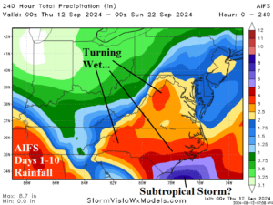
Discussion: An area of low-pressure forms near or south of a frontal boundary off the Southeast U.S. Coast late this weekend and gradually strengthens over the warm waters near the Gulf Stream. A subtropical or tropical storm may develop. Rainfall forecasts are increasingly buoyant with excessive rain possible on the Carolina Coast and inches of rain spread across the Mid-Atlantic States next week.
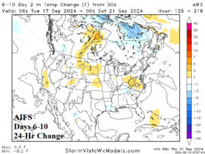
Medium-range 6-10 Day Forecast Valid September 17-21, 2024 (24-hour change)
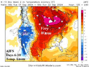
Discussion: Not much change in the 6-10-day forecast which features contrasting cold in the Great Basin and potential record warmth in the Central U.S. to much of Canada.
Medium-range 11-15 Day Forecast Valid September 22-26, 2024 (24-hour change)
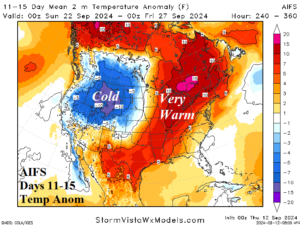
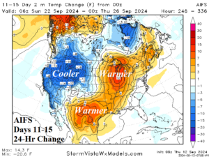
Discussion: AIFS is much cooler in the West where the outlook was already unusually cold. Meanwhile, the warm forecast from Texas to Quebec trends warmer.
U.S. Medium-range Precipitation Forecast
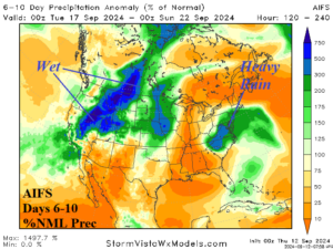
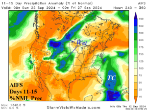
Discussion: The AIFS cold West/Warm Central thermal boundary in the medium-range forecast leads to a stormy pattern from the Interior West to North-central U.S. The Mid-Atlantic States are also singled-out as a heavy rain zone in the 6-10-day forecast with possible added rain associated with a tropical risk in the 11-15-day period.
Days 16-20 Extended range Temperature Forecast valid September 27-October 1, 2024
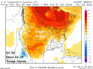
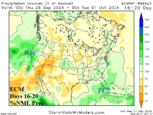
Discussion: Persistence is used by ECM and CFS V2 maintaining a warm outlook. Wet weather risk is on each coast.