U.S. Population Weight CDD’s for Summer 2024
09/04/2024, 10:53 am EDTTropical Cyclone Expected Western Gulf of Mexico This Week
09/08/2024, 9:30 am EDTCharts of the day: Norwegian Sea marine heat wave (MHW) and September 2024 upper air.
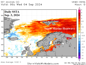
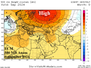
Discussion: The ongoing impressive marine heat wave (MHW) across the Norwegian Sea continues and the persistent high-pressure ridge well-correlated to this feature remains locked-in across Northwest Eurasia according to the ECMWF “monthlies”.
Week-2 Ahead Forecast valid September 15-21, 2024: Black Sea region trend is wetter; Staying dry and warm to the north.
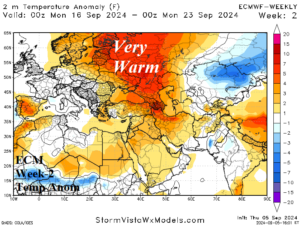
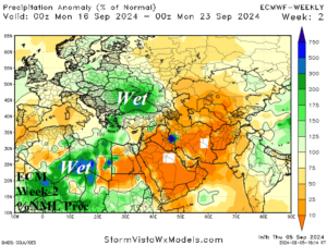
Discussion: The upper ridge anchored over Northwest Eurasia remains and maintains the anomalous warmth across this region. South of the ridge, an upper low causes heavy rains in the Black Sea region.
Week-3 Ahead Forecast valid September 22-28, 2024: Warm pattern edging westward.
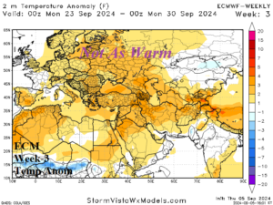
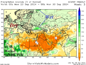
Discussion: ECM attempts to push the upper ridge westward to warm Central and Southwest Europe where mostly dry weather is likely. Lingering wet weather in the Black Sea region to Southwest Russia is expected.
Week-4 Ahead Forecast valid September 29-October 5, 2024: Northwest Russia cooler; Central/Southwest Europe is warm.
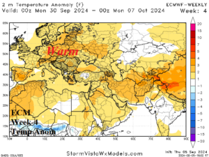
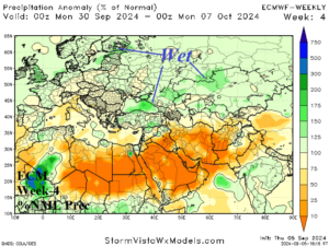
Discussion: ECM broadens an upper trough over Northwest Eurasia causing a cooler change. The warm regime is centered on Southwest to Central Europe. A showery regime lingers from the Black Sea region to Northern Kazakhstan.