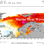
The Norwegian Sea Marine Heatwave
08/13/2024, 8:10 am EDT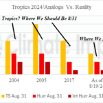
The 2024 Tropical Cyclone Activity Is Lagging The Analogs
08/19/2024, 8:31 am EDT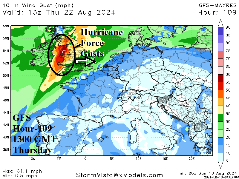
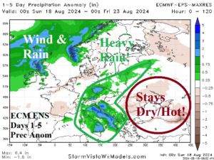
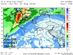
Fig. 1-2: ECM ENS 1-5-day rainfall anomaly forecast and GFS wind gust potential across Ireland/U.K. on Thursday.
Discussion: Heavy rains over the weekend in Austria with more on the way! An intense upper trough is shifting toward Italy early this week. Consequently, a large area of heavy rain is forecast especially across Italy with more to the north throughout South-central Europe and across Poland (Fig. 1). Additionally, a period of damaging high wind associated with “Ernesto” is forecast to streak across Ireland and U.K. Thursday featuring hurricane force gusts (Fig. 2). East of the wet weather shifting into South-central Europe, the Black Sea region stays dry and hot through the next 15 days (Fig. 3-4), intensifying an already intense drought (Fig. 5).
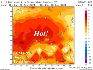
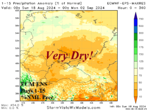
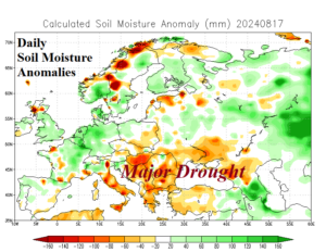
Fig. 3-5: ECM ENS temperature anomaly and percent of normal rainfall forecast through the next 15 days and the Europe soil moisture anomaly analysis.
A dramatic difference between the warmth across Brazil this week and the cooling trend returning to Argentina. A strong cold front separates the two air masses. The cold front moves north in teh6-10-day period causing 1-3 in. of rain from Paraguay eastward across Southeast Brazil (Fig. 6). After the rainfall, a cold burst into Southeast Brazil as temperature anomalies are >20F below normal (Fig. 7). A near miss freeze for far southern coffee growing areas in Southeast Brazil.
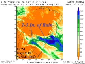
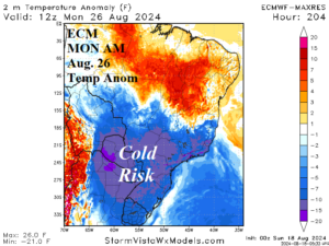
Fig. 6-7: The ECM 6-10-day percent of normal rainfall forecast for Brazil and ECM temperature anomaly forecast for the morning of Aug. 26, 2024.
Rapid intensification or development of drought remains in place across Northern Texas and Southern Oklahoma eastward to North-central Mississippi through late August due to persistent dryness (Fig. 8) and attendant hot weather. However, the Canadian Prairies enjoy needed showers for much of the next 10 days (Fig. 9) before a drier pattern change after 10 days.
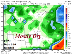
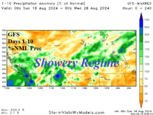
Fig. 8-9: The ECM rainfall 10-day forecast for the U.S. AG Belt and GFS percent of normal 10-day rainfall forecast for the Canadian Prairies.