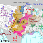
High Wind Central/East-central U.S. Plus Major Tornado Outbreak Late Today/Tonight
03/14/2025, 3:42 pm EDT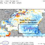
North Atlantic Basin is Still Warmer Than Normal but Cooler Than 1 Year Ago
03/19/2025, 8:37 am EDT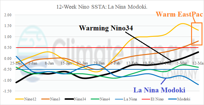

Fig. 1: The 12-week Nino region(s) weekly SSTA tracker reveals the evolution of La Nina Modoki.
Discussion: The Modoki index continues to strengthen as La Nina characteristics persist near the Dateline while warming in the eastern equatorial Pacific is dramatic (Fig. 1). Currently, one of the strongest La Nina Modoki episodes on record is strengthening. The NINO34 SSTA is monitored for oceanic ENSO classification and has warmed to +0.3C during the past week. The Nino3 and Nino12 SSTA regions are already well within El Nino range. In the subsurface, cool fuel to sustain L a Nina in the equatorial East Pacific has diminished rapidly (Fig. 2). Interestingly, the warming is local to the East Pacific equatorial region rather than via an eastward shifting Kelvin Wave from the West Pacific. Westerly wind at the surface since earlier this year has caused the eastern equatorial surface and subsurface to warm. If this pattern were to continue, a negating influence on North Atlantic tropical cyclone season generates. ECMWF (is the only) global SSTA forecast maintaining warm Nino12/Nino3 while not generating El Nino. Globally, marine heat waves (MHW) dominate especially in the southern hemisphere and are the primary contributor to the record warm global ocean surface (Fig. 3). The Indian Ocean Dipole (IOD) is neutral while persistent (new) cool phase Pacific decadal oscillation (-PDO) (also) continues.
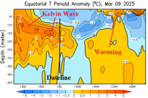
Fig. 2: The equatorial Pacific Ocean upper ocean heat anomalies. Note cool anomalies east of the Dateline are diminishing rapidly as cool fuel to sustain La Nina is fading.
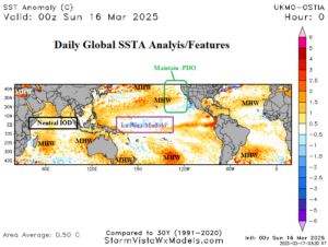
Fig. 3: The daily global SSTA analysis.