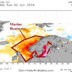
Marine Heat Waves/North Atlantic Warm Hole Climate Causal to Historic Southern Germany Floods
06/04/2024, 2:28 pm EDT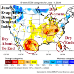
Western Corn Belt Flooding; Eastern Corn Belt Drought Risk. Southern Texas Drought Erased.
06/16/2024, 9:22 am EDT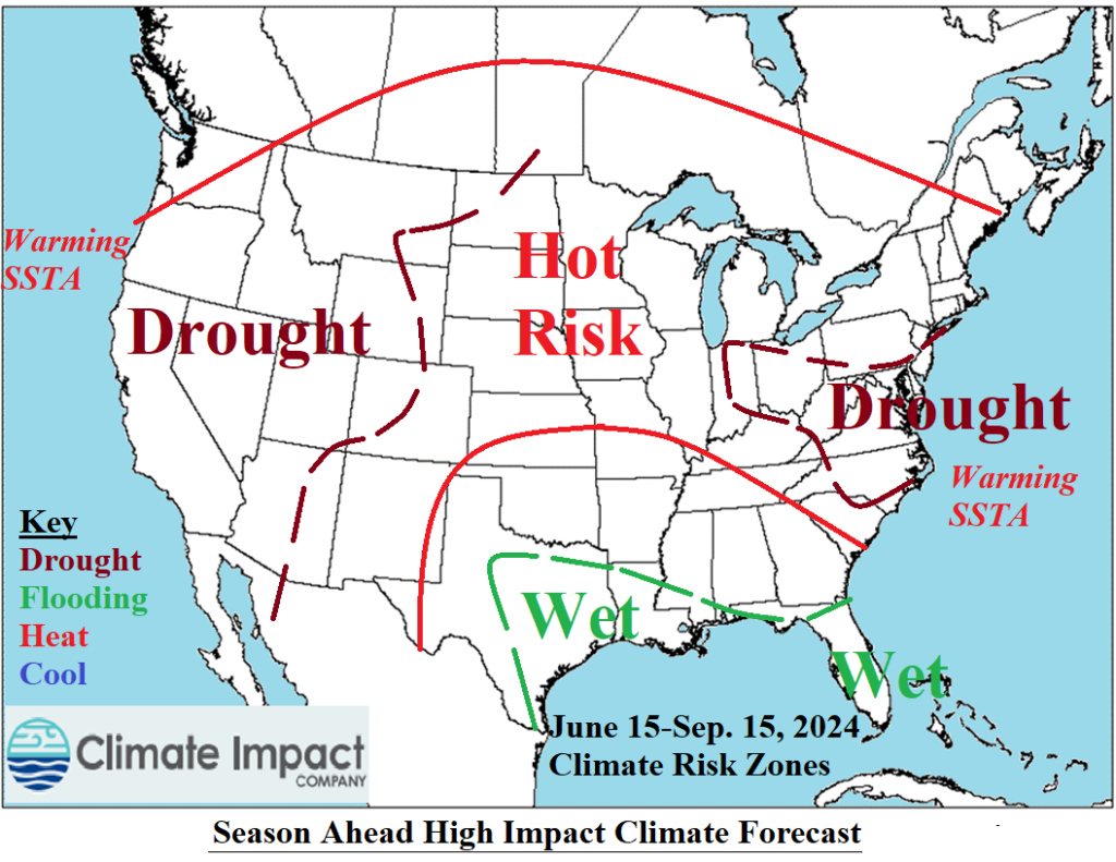
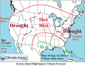
Fig. 1: Projected high impact climate zones for the U.S. through the next 3 months.
Discussion: Medium-range forecasts, SSTA trend in the Northeast Pacific and West Atlantic, and soil moisture trend are helping to clarify with certainty where high impact climate zones will set-up well into the summer season (Fig. 1). Expectations of Northwest U.S. drought remain. However, in California, drought risk is increasing. Return hot weather events as observed in recent days are likely to return with greater intensity. Supporting this forecast is the apparent eastward shift of a marine heatwave northeast of Hawaii almost to the U.S. West Coast in recent days. Additionally, the Southwest U.S. monsoon is expected weaker than normal this year enabling the California dry risk. The West U.S. becomes a hot weather source region. Pulsing of the anomalous heat eastward occurs on a steady basis. Targets are the Midwest States and eastward to the Mid-Atlantic region and Northeast areas. Unclear is whether the Midwest is drier than normal or struck by residual moisture from the busy tropical pattern in the Gulf. However, the Mid-Atlantic region is drying, and drought is expected mid-summer enhancing hot weather when present. Texas is likely to turn very wet during mid-to-late June. Drying soils in the north coastal region of the Gulf of Mexico in recent weeks will reverse wet (again) due to influence of tropical rains. Additionally, Florida turns very wet, and the ongoing drought will fade.
Colorado State University has updated their April 4 North Atlantic basin tropical cyclone season forecast. There is no change to the original outlook which maintains 11 hurricanes and 5 intense hurricanes and a titanic ACE index of 210.
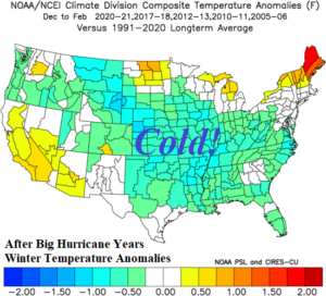
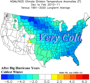
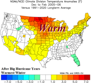
Fig. 2-4: Following seasons when 10 or more hurricanes were observed the winter season has a tendency for colder than normal conditions (top) with the cold and warm extremes indicated.
Tropical cyclone seasons producing more than 10 hurricanes this century have been followed by colder than normal winter seasons. Hurricanes up-well the buoyant warm water to the surface and cause the ocean to cool lasting into the winter season. The cooler waters, unusual in the modern climate, support increased risk of colder weather during the winter season. The average winter temperature anomaly scenario focuses cold weather on the Central/Mid-south U.S. (Fig. 2). The cold extreme is winter of 2010-11 (which was frigid, Fig. 3) while the only warm winter (of the 5 analog years) occurred in 2005-06 (Fig. 4).