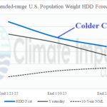
U.S. Gas Population Weight HDD Forecasts Trending Colder/Longer Duration
12/29/2024, 10:02 am EST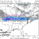
Heavy Snow and Ice Storm Ahead for Lower Midwest States
01/02/2025, 4:58 am ESTDaily IOD Index: -0.31 (-IOD weakens)
Daily Nino34: -0.84 (Moderate strength La Nina)
Daily TSA Index: +0.48 (warm phase is slightly stronger)
Daily SOI: -0.76 (first El Nino-like daily observation in 50+ days)
Charts of the day: 90-day and 30-day percent of normal rainfall.
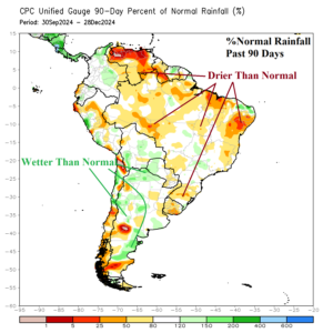
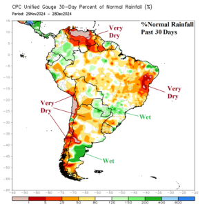
Discussion: Quarter 4 of 2024 was drier than normal across most of Brazil while much of Argentina was wetter than normal. During December, Paraguay and eastward to the Southeast Brazil Coast was wet while Central/East Argentina and Central/East Brazil were dry. South-central/Coastal Argentina was very wet. Dryness over northwest continent persists while Central America was wet.
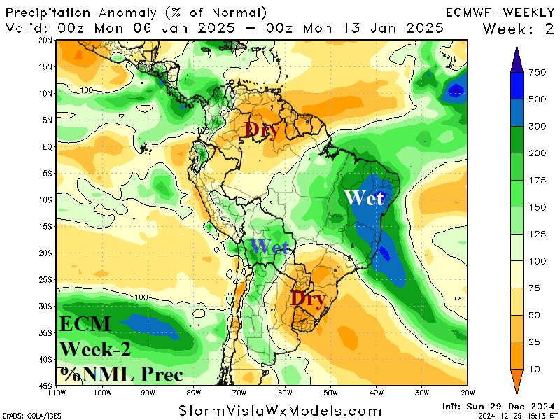
Week-2 Valid January 5-11, 2025: Heavy rains East/Northeast Brazil remain in forecast.
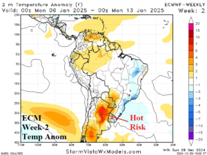

Discussion: Strong upper-level low pressure rests on the Southeast Brazil Coast and is positioned to unload significant rain on East/Northeast Brazil with the western edge of the wet weather pattern reaching Central Brazil. No rain is forecast for Northeast Argentina to Southeast Brazil.
Week-3 Valid January 12-18, 2025: Brazil stays wet.
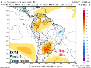
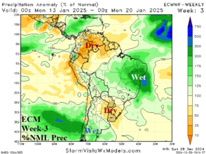
Discussion: Weak upper low rests over Southwest Brazil during the period and maintains the wet risk across Central/East/Northeast Brazil. Dryness anchors across Northeast Argentina.
Week-4 Valid January 19-25, 2025: Wet bias remains in Brazil.
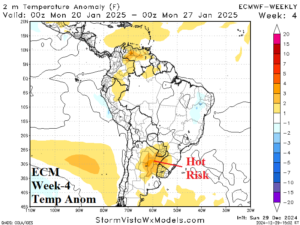
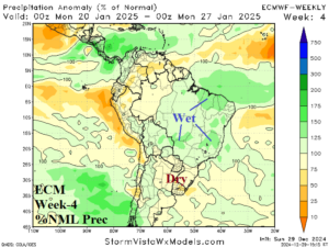
Discussion: Weak upper trough is projected by ECM across West-central Brazil providing enough instability to bias the Brazil pattern wetter than normal while Northeast Argentina is dry.

