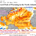
Tropical Feature: The westward push of a warming ocean surface in the North Atlantic.
05/28/2024, 3:54 am EDT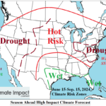
The High Impact Climate Risk Zones in The U.S. for Summer 2024
06/11/2024, 2:54 pm EDT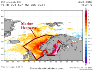
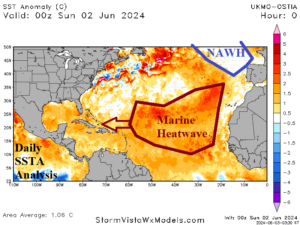
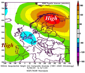
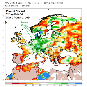
Fig. 1-4: Intense marine heat waves surrounding Northern Europe and in the subtropical North Atlantic, the recent (related) upper air pattern, and 7-day percent normal rainfall across Europe.
Discussion: The ocean surface surrounding Scandinavia is “hot”! Sea surface temperature anomalies (SSTA) range from +4C to near +7C in the Baltic Sea to +2C to +4C west and southwest of Norway (Fig. 1). This specific marine heat wave (MHW) is peaking in strength. However, the anomalous warmth in this region extends back to late last decade. Meanwhile, another long-lasting MHW off the northwestern coast of Africa born last year remains intense and has shifted westward into the subtropical North Atlantic (Fig. 2). In-between the two MHW’s, the semi-permanent 2014-24 North Atlantic warm hole (NAHW) is vividly present southeast of Greenland where SSTA is near normal while surrounding areas are warm. We’ve seen the response of the upper air to the regional SSTA regimes described on many occasions during the past decade. The most recent example is the warming atmosphere aloft across the MHW regions responsible for high-pressure ridge areas this time off Portugal with a second titanic ridge over Scandinavia (Fig. 3). In-between, and in a familiar location, near or east of the NAWH, an intense low-pressure system. In this case, the attendant storm system is entraining moisture from the warmer than normal waters off Southwest Europe and the Mediterranean Sea forcing extreme rainfall potential. Realized is excessive rainfall causing historic flooding in Southern Germany (Fig. 4). The word “historic” is used purposely. The climate conditions leading this event, most notable in the SSTA patterns, are unique and characteristic of climate change.

