Marine Heatwave Influence Dominate Australia Month 1-4 Ahead Climate Outlook
12/15/2024, 7:54 pm EST
Snowy and Cold East U.S. Early to Middle January!
12/28/2024, 6:35 am ESTExecutive summary: Marine heatwaves remain a dominant force on global climate as 2024 ends. Climate Impact Company identifies one dozen well-organized MHW’s with each expected to continue into the New Year. The dominant presence of MHW’s may have slowed La Nina onset. MHW’s bias oceanic regions (and nearby land masses) with above normal strength high pressure aloft (warmer climate) and increased low-level atmosphere moisture to propel over-achieving storms.

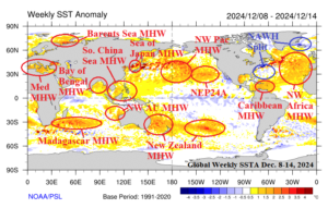
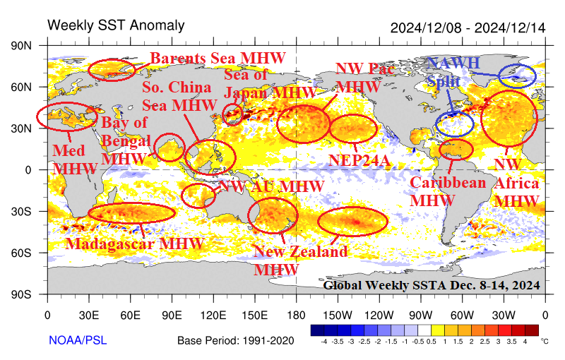
Fig. 1: Global marine heatwaves as of the week of Dec. 8-14, 2024.
Discussion: In November 2024, 29% of the global oceans were covered by marine heatwaves (MHW) according to NOAA ranking 20th of all months since 1991. The global oceans are the second warmest to 2023. Climate Impact Company (CIC) identifies 9 MHW’s across the northern oceans and an additional 3 MHW’s in the southern oceans. The North Atlantic warm hole (NAWH) split during mid-to-late summer and persists in meteorological winter. Trend comments (based on NOAA monthly SSTA) and forecast comments (using primarily ECMWF SSTA forecasts) are indicated.
Northern hemisphere…
- NEP24A: Weakened; Northeast Pacific trends somewhat cooler. Outlook: ECMWF indicates strengthening; CIC prefers steady moderate intensity.
- Northwest Pacific: Slightly weaker; broadened near Dateline. Outlook: Strengthening, shifting east according to ECMWF, a forecast that is too aggressive.
- Sea of Japan: Steady and very intense. Outlook: Weakening.
- South China Sea: Steady moderate strength. Outlook: Slight weakening.
- Bay of Bengal: Slowly strengthening. Outlook: Steady intensity.
- Mediterranean Sea: Core of warming shifting westward. Outlook: Slightly weaker.
- Barents Sea: A little weaker. Outlook: Steady.
- Northwest Africa: Large MHW, broadening/warming. Outlook: Steady.
- Caribbean Sea: Steadily very warm. Outlook: Steady; Gulf of Mexico warms.
- NAWH: Reorientates to south of Greenland.
Southern hemisphere…
- Northwest Australia: Strengthened although weaker influence on IOD. Outlook: Strengthens, shifts south.
- New Zealand: Broadening and strengthening. Outlook: Large and strengthening.
- Madagascar: Strengthened. Outlook: Strengthens while shifting south.
The MHW’s surrounding Europe strongly supports a milder than normal winter season in that region. The fading southern cool pool off the U.S. East Coast is causal to lowering risk of East Coast cold as observed during early December for the mid-to-late winter season. CIC doubts the expansion and strengthening of North Pacific MHW’s preferring a cooler scenario for the northern and northeast portion of the North Pacific which should sustain ongoing strong cool phase of the Pacific decadal oscillation (PDO). MHW’s in the Northern Indian Ocean to South China Sea should support wetter than normal climate for Q1/2025 for those regions. A strong MHW east of Australia will lead to a strong subtropical ridge across that region.

