05/31/2024, 8:15 am EDT

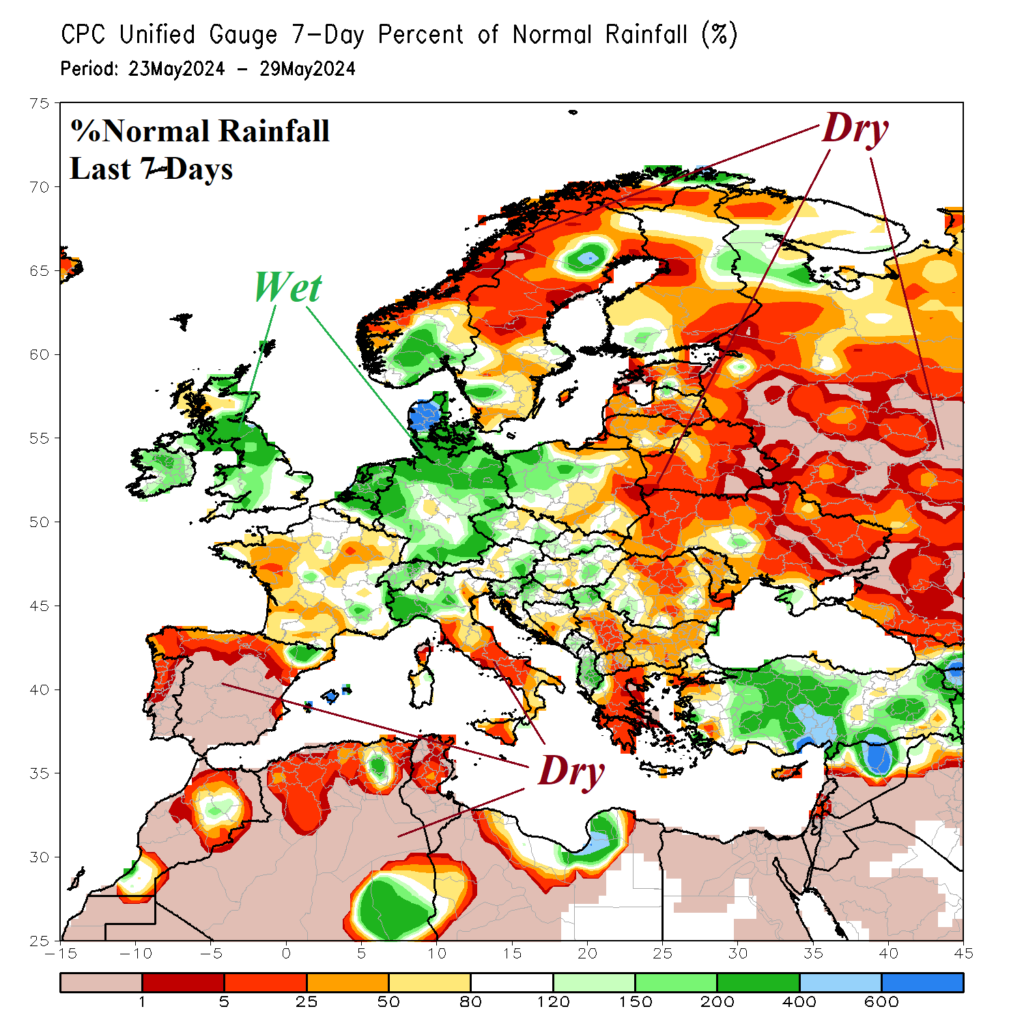
The past 7 days have featured prohibitive dryness across Eastern Europe, Western Russia, and into the Northern Black Sea region. The ECM 10-day rainfall anomaly outlook indicates the Black Sea region to Southwest Russia stays mostly dry while Europe showery conditions persist and reach far Western Russia.
