03/02/2026, 1:35 pm EST
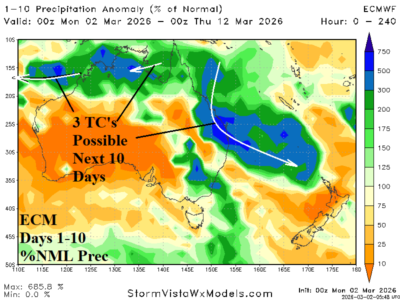
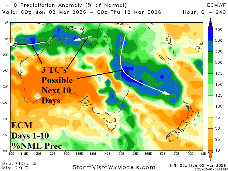
As many as 3 tropical cyclones are forecast to affect the northwest, north, and east coastlines in the latest 10-day rainfall outlook for Australia according to ECMWF. The core of the heavy rain (and extended range) is across Queensland.