10/28/2025, 8:53 am EDT
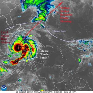
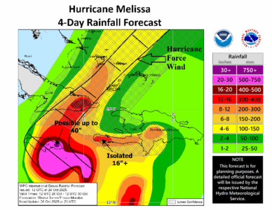
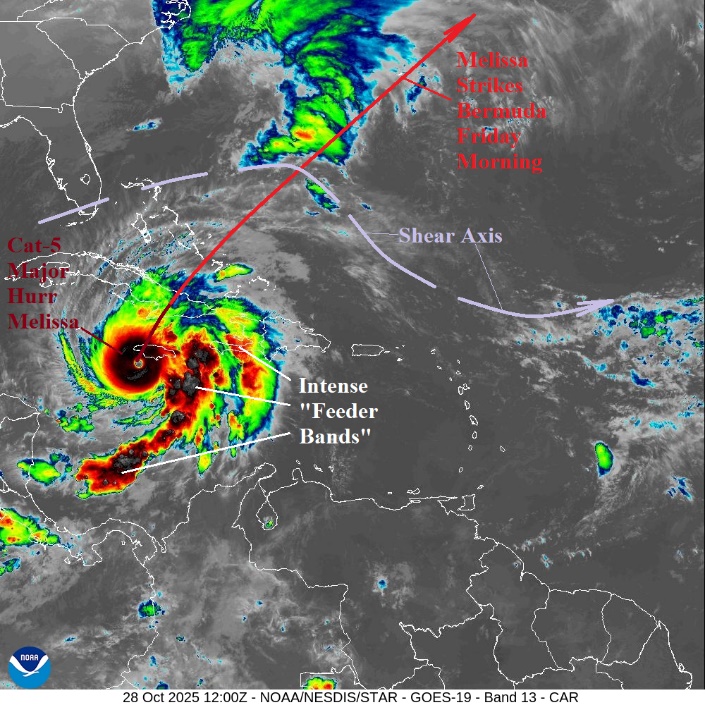
At 8AM EDT, Category-5 Major Hurricane Melissa was located about 55 miles south-southeast of Negril, Jamaica with central pressure 901 MB and top wind 175 mph while moving north-northeast at 7 mph. HWRF/HMON hurricane forecast models lower surface pressure to around 890 MB today forcing maximum wind to around 190 mph.