U.S. Soil Moisture FEB-24 Vs. FEB-25, Expectations for Summer
02/26/2025, 2:00 pm EST
Potential Impacts on U.S. of Upcoming Stratospheric Warming
02/28/2025, 5:47 am EST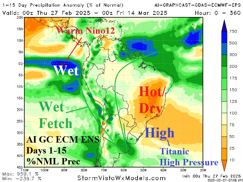

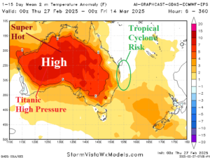
Fig. 1-2: The Graph Cast 15-day percent of normal precipitation forecast across South America and 15-day temperature anomaly outlook across Australia.
Discussion: Forecasts remain wet in Argentina while the eastern half of Brazil is very dry through the next 15 days (Fig. 1). The outlook is based on a wet fetch extending from the El Nino-like warming of the Nino12 region off the northwest coast of South America southeastward around an amplified subtropical high pressure on the Southeast Coast of Brazil soaking Argentina. Meanwhile, the high pressure brings heat and dryness to Brazil. Similarly, another titanic high-pressure system brings the hottest anomalies of calendar summer to Australia (Fig. 2) while a tropical cyclone drifts south likely staying off the East Coast. In the U.S. AG Belt, GFS is on its own bringing above normal precipitation most focused in the 8-14-day period (Fig. 3). Snowfall is likely across the Upper Midwest with severe weather possible in the Mid-south later in the period. Other forecast models are much drier. In Europe, sprawling high pressure is in the forecast as a warm-up with dryness is expected through the first third of March (Fig. 4). The cold weather near and east of the Black Sea region slowly abates.
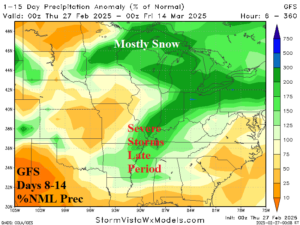
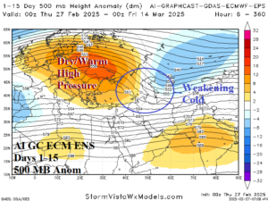
Fig. 3-4: The GFS 8-14-day percent of normal precipitation forecast across the U.S. AG Belt and Graph Cast 15-day upper air forecast for Europe/Russia.