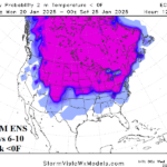
Frigid Weather Next Week in U.S.; Zero F Risk Across Great Plains to Northeast
01/15/2025, 8:52 am EST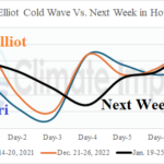
Houston Wednesday Morning Temperature Revised to Frigid Teens (Close to Uri/Elliot Peak Cold)
01/18/2025, 11:12 am ESTChart of the day: Status of Great Lakes ice.
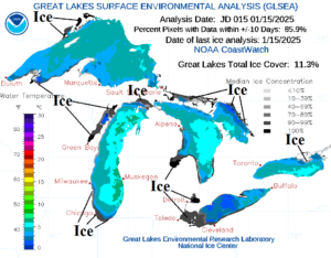
Discussion: Great Lakes ice is emerging and should spread rapidly given the long duration cold pattern ahead. Open water moderates arctic air. However, once ice is sufficiently expansive the moderating effects cease.
Medium-range 6-10 Day Forecast Valid January 21-25, 2025 (24-hour change)
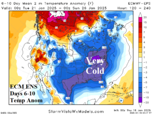
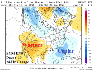
Discussion: The 6-10-day cold forecast shifts the core of the cold pattern to the central Appalachians and includes the Mid-Atlantic States. The Gulf States are also very cold. The Southwest U.S. trends warmer since yesterday.
Medium-range 11-15 Day Forecast Valid January 26-30, 2025 (24-hour change)
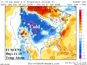
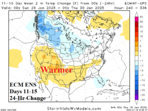
Discussion: The 11-15-day forecast produces new cold over snow cover of Western Canada and the northwest Great Plains. The East moderates toward normal while the Southwest continues to shift warmer.
U.S. Medium-range Precipitation Forecast
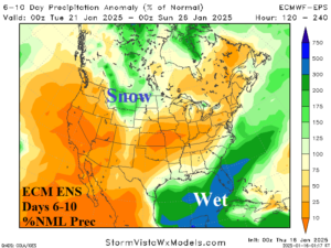
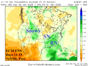
Discussion: A rainstorm for Florida in the 6-10-day forecast while much of the Southeast U.S. is stormy in the 11-15-day period. Piling snows across the central and northern Rockies to the northern Great Plains.
Days 16-20 Extended range Temperature Forecast valid January 31-February 4, 2025
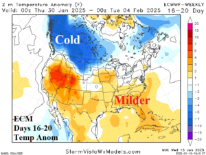
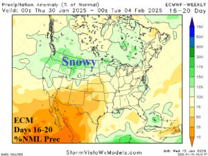
Discussion: Trending toward a La Nina climate as February arrives with mild temperatures across the South and very cold weather in Western Canada

