North Atlantic Basin 2025 Preliminary Tropical Cyclone Outlook
12/11/2024, 1:28 pm EST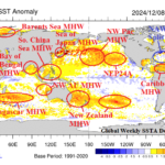
December 2024 Global Marine Heatwaves Outlook
12/17/2024, 4:09 pm ESTExecutive Summary: The Climate Impact Company constructed analog (CIC-CA) climate forecast across Australia for JAN-APR 2025 is updated. The forecast is based primarily on the influence of continental climate by the ominous presence of marine heat waves and a weak La Nina episode. Forecast highlights for Q1/2025 include a warmer than normal climate for most of the continent, areas of dryness across the interior Northwest and Southern Queensland to northwestern New South Waels. The wet regions are somewhat confined to coastal regions and the outlook trend is drier than previously indicated. The outlook implies steady or worsening drought on the South Coast and evolving drought across southern Queensland into northern New South Wales. Tropical cyclone activity is above normal with strongest risk of coastal strikes late in the season.
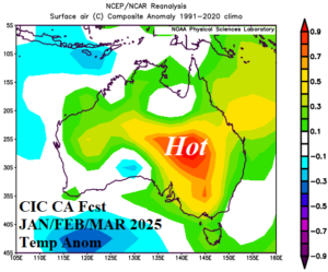
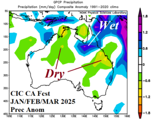
Fig. 1-2: The Climate Impact Company constructed analog temperature and precipitation anomaly forecast for JAN/FEB/MAR 2025.
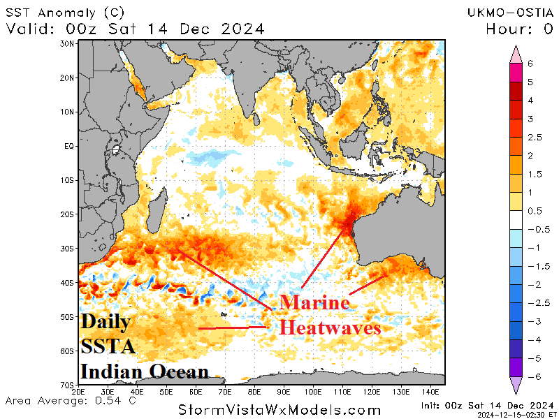
Climate discussion: Once again, marine heatwaves (MHW) are emerging as a significant influence on prevailing climate affecting Australia sensible weather. Currently, MHW episodes are strengthening in the southwest Indian Ocean, ongoing off the northwest coast of Australia, and developing south of Australia (Fig. 3). Additionally, a lengthy and increasingly intense MHW stretches eastward from the East Coast of Australia past the Dateline (Fig. 4). Meanwhile, much awaited oceanic La Nina is finally developing as Nino34 SSTA shifts firmly past the La Nina threshold (Fig. 5). The upper air pattern since Nov. 1 responds to the MHW locations as high pressure amplifies across the regionally warm SSTA zones with a compensating upper trough in-between located south of the continent (Fig. 6). The prevailing weather pattern since Nov. 1 is warmer than normal across much of the continent especially in the East with patchy wet areas that have increased soil moisture for Australia mostly away from coastal areas (Fig. 7). The GFS ENS 15-day rainfall anomaly forecast for the remainder of December trends drier compared to the recent pattern except wet on the northern coast (Fig. 8).
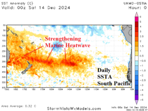

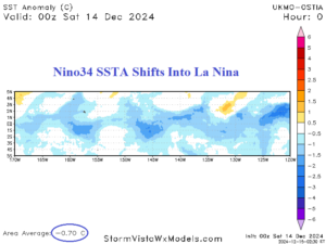
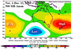
Fig. 3-6: Daily sea surface temperature anomalies (SSTA) across the Indian Ocean and South Pacific Ocean, Nino34 SSTA, and Nov. 1-Dec. 12, 2024, upper air pattern surrounding Australia.
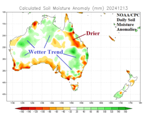
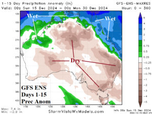
Fig. 7-8: NOAA/CPC daily soil moisture anomaly analysis across Australia and the GFS ENS 15-day rainfall anomaly outlook.
The global SSTA forecast valid for February 2025 by ECMWF (Fig. 9) projects MHW episodes in the southwest Indian Ocean, vicinity of Australia, and across the subtropical South Pacific strengthening. Weak La Nina is ongoing in February. The regionally warm MHW episodes and weak La Nina is used to generate a constructed analog climate forecast for Australia through the first 4 months of 2025.
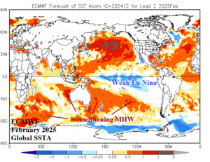
Fig. 9: ECMWF global SSTA forecast for February 2025 and lead regional SSTA zones having climate influence on Australia.
January 2025: The upper ridge stretched across the Australia/New Zealand marine heatwave continues. Mid-summer anomalous heat is impressive across the southeast quadrant of Australia. To the north, an upper trough on the northwest coast of the continent triggers a wet climate suppressing anomalous heat risk for the northern 1/3 of Australia. Forecast confidence (for January) increases as the constructed analog identifies the correlation between the MHW and upper ridge.

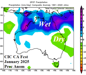
Fig. 10-11: The Climate Impact Company constructed analog temperature and precipitation anomaly climate forecasts for January 2025.
February 2025: Forecast confidence for February remains below average. The constructed analog reverses the upper air pattern across the MHW east of Australia to an upper trough. The attendant wet weather is confined to the New South Wales Coast while much of the continent is beneath the subsidence trailing the upper trough and therefore widespread dryness. Anomalous heat is centered on southwest Queensland and vicinity.
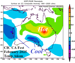
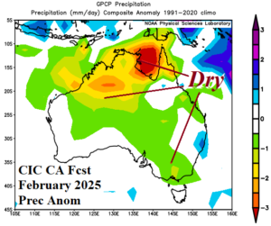
Fig. 12-13: The Climate Impact Company constructed analog temperature and precipitation anomaly climate forecasts for February 2025.
March 2025: The late calendar summer forecast trend is hotter as most of the continent is warmer than normal. Wet climate is patchy and confined to parts of the north and east continent.
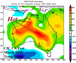
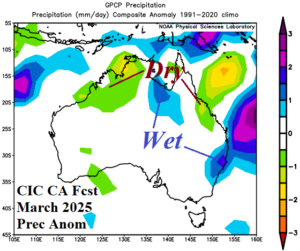
Fig. 14-15: The Climate Impact Company constructed analog temperature and precipitation anomaly climate forecasts for March 2025.
April 2025: As the autumn season arrives, a wet climate is forecast across northeast continent. There is the possibility of late seasonal above normal tropical cyclone activity affecting the coastal northeastern quadrant of the continent. Central and East Australia are warmer than normal while the West Coast is cooler than average.
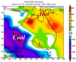
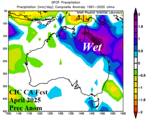
Fig. 16-17: The preliminary Climate Impact Company constructed analog temperature and precipitation anomaly climate forecasts for April 2025.

