ECM and CFS V2 in Disagreement on 2nd Half of December in U.S.
11/27/2024, 10:38 am EST
Potential Regenerating Cold in the Northeast U.S. Early January
12/02/2024, 8:00 am ESTHighlight: Coldest start to meteorological winter in U.S. since 2018, developing cold and snow in Europe next week, and Brazil rains shift southward.
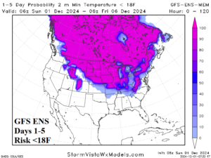
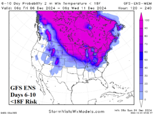
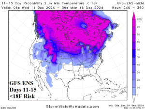
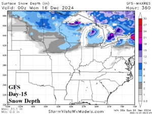
Fig. 1-4: GFS ENS risk of <18F forecast for the next 15 days and the day-15 snow cover forecast for the U.S. AG Belt by the GFS.
Discussion: Meteorological winter begins very cold across the U.S. AG Belt. The risk of <18F mornings (and sub-freezing days) covers the Upper Midwest toward the Ohio Valley this week (Fig. 1), expands during the 6-10-day period (Fig. 2), and begins to retreat in the 11-15-day period (Fig. 3). The snow cover steadily advances reaching the Midwest States and northern Ohio Valley during the next 2 weeks (Fig. 4). The cold first third of December across much of the eastern half of the U.S. is the first since 2018. In 2018, the second half of December was extremely warm.
A colder pattern across West/Central Europe emerges in the medium range according to ECM (Fig. 5). During the colder transition, a large area of precipitation centered on Central Europe is indicated (Fig. 6). As the colder weather strengthens, precipitation is over to mostly snow for Central to Southeast Europe and the Southern Mountains.
In South America, the recent rainfall trend is broadening and intensifying rainfall across much of Argentina (Fig. 7). Wet weather extending from central to eastern Brazil is ongoing. The Argentina/Brazil long-term drought regions have certainly improved during the late spring rains. As meteorological summer arrives, the GFS pushes the wet weather regime to Uruguay and Southeast Brazil as Central/East Brazil plush most of Argentina shifts drier (Fig. 8).
Much of Australia was wetter and warmer than normal during November (Fig. 9). The most dominant feature in the upper air pattern was an amplified upper-level high-pressure ridge centered on New Zealand. A marine heat have (MHW) is redeveloping between Australia and New Zealand. The New Zealand ridge holds this week propelling more anomalous heat across Eastern Australia. Heavy rains are likely on the North Coast this week with some of that rainfall breaking across East-central New South Wales. During the medium range a weak ridge stretches across Southwest/South Australia while the New Zealand ridge weakens. Short-term warmth should ease as much of the continent is wetter than normal into mid-December (Fig. 10).
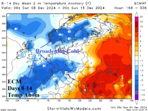
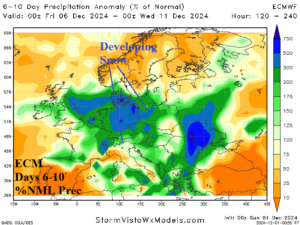
Fig. 5-6: The ECM 8-14-day temperature anomaly forecast across Europe and percent of normal precipitation outlook for the 6-10-day period.
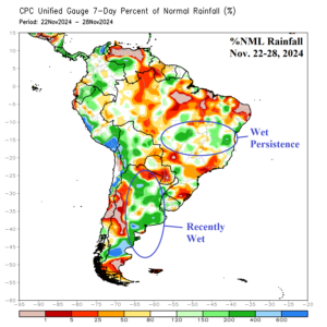
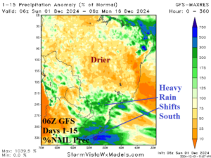
Fig. 7-8: Percent of normal rainfall observations for South America during the past week and most recent GFS 15-day percent of normal rainfall forecast.
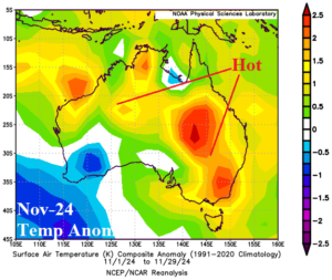
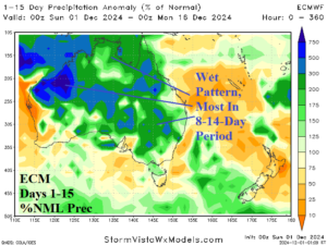
Fig. 9-10: The temperature anomalies across Australia for Nov. 1-29 and the ECM 15-day percent of normal rainfall forecast.

