ECM ENS Continues Highest Skill in Medium-range
11/14/2024, 11:46 am EST
Big Storms Ahead in U.S., Especially for the West Coast
11/17/2024, 10:09 am ESTCharts of the day: Upper air pattern/wet climate in Brazil.

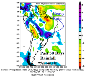
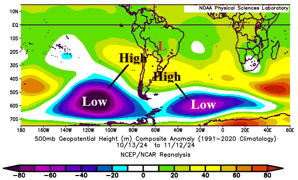
Discussion: An intense upper-level low-pressure system southwest of South America is compensated by an upper ridge with two centers either side of South America. In-between high-pressure areas, a low-pressure area over Southwest Brazil causes a streak of heavy rain during the past 30 days across a previous drought zone.
Week-2 Valid November 24-30, 2024: Wet Argentina and East Brazil.
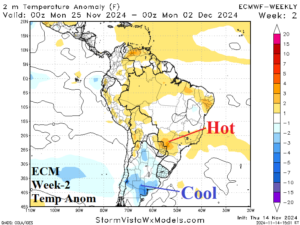
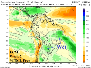
Discussion: Upper trough stretches across North-central Argentina causing a wetter regime in Argentina, similar with previous outlook. A wetter change is indicated for East Brazil.
Week-3 Valid November 1-7, 2024: Southeast Brazil rains.
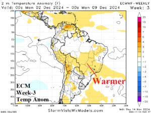
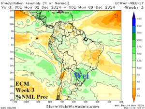
Discussion: The upper trough is centered on Central Argentina causing a wet pattern for Southeast Brazil while areas to the north is drier.
Week-4 Valid December 8-14, 2024: Widening warmth and dryness.
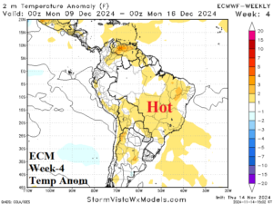
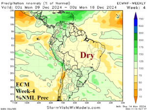
Discussion: Anomalous heat and dryness is widening aerial coverage as mid-December approaches.

