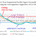
Forecasting ENSO Phase is Extremely Difficult
11/01/2024, 8:30 am EDT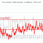
Warm Atlantic Multidecadal Oscillation Responsible for Warm Europe Winters of Late
11/07/2024, 8:41 am EST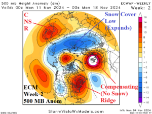
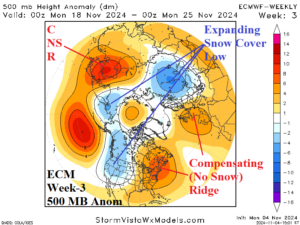
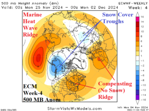
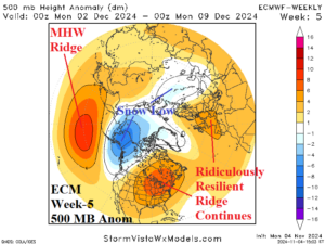
Discussion: An expanding Northern Eurasia snow cover cools the atmosphere aloft and forces a broad low-pressure trough during mid-November. To compensate, a ridiculously resilient ridge (RRR) stays intact across eastern North America and Western Europe enhanced by lack of snow cover and a marine heat wave (MHW) west of Europe. The RRR pattern holds in late November as the Eurasia Low splits to Northeast Asia/Western North America and Southwest Russia. By early December the low pressure is deepest over Alaska where deep snow cover is likely. In early December the RRR pattern is expanding across the eastern half of the U.S. and stays attached northeast of the MHW to the west of Europe. Another RRR pattern forms over the next few weeks across the West/Central Pacific MHW. During the first fill week of December, ECM forecasts persistence, a deep trough over snow-buried Alaska while a broad trough lingers over snow-covered Western Russia compensated for RRR regimes across eastern North America and western Europe. History: The RRR pattern is a climate change regime initiated (and named) during the 2013-14 winter season when an upper ridge pattern extended northward from a MHW in the Northeast Pacific and across Alaska to Siberia persisting all winter-long and compensated for by a downstream polar vortex over Canada which delivered record cold and snow to the Eastern U.S.
Week-2 Ahead Forecast valid November 10-16, 2024: Very warm East; Heavy rains Mid-south States.
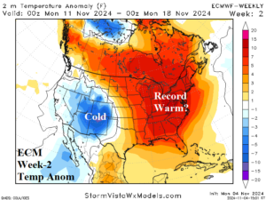
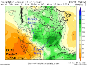
Discussion: South of the RRR pattern, the tropics are active. Influence of tropical rains extend inland to the Mid-south States during the period. Additionally, an upper trough triggers significant snow in the Central Rockies.
Week-3 Ahead Forecast valid November 17-23, 2024: Staying warm in the East; Stormy Tennessee Valley/Upper Midwest.
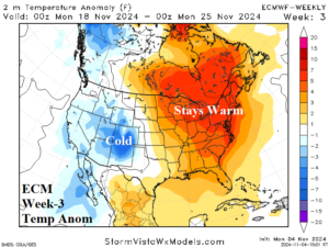
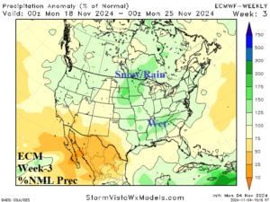
Discussion: The RRR pattern continues and leaves the East very warm. In-between the upper ridge and a Western U.S. trough, a wet pattern persists from the Tennessee Valley to the Upper Midwest where some of the precipitation is heavy snow.
Week-4 Ahead Forecast valid November 24-30, 2024: Staying warm East, Chilly Interior West.
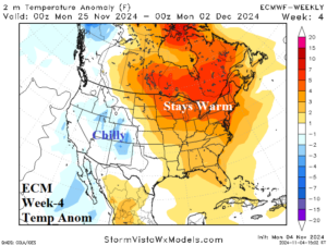
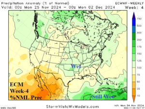
Discussion: The warm pattern across eastern North America holds. The Interior West stays chilly where impressive early season snow cover is present, especially across the Central Rockies. Note the tropics are still busy with heavy rain and possible late season organized activity.

