Early November Tropical Cyclone Risk Update
10/26/2024, 10:19 am EDT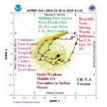
Madden Julian Oscillation Rolling Eastward Again; Affects Weather Patterns
10/28/2024, 5:54 am EDT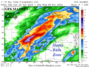
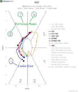
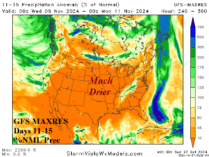
Fig. 1-3: GFS MAXRES 10-day rainfall amount forecast, 14-day MJO outlook, and GFS MAXRES 11-15-day rainfall amount.
Discussion: The latest rainfall outlook for The Great Plains continues to project a heavy rainfall episode developing mid-to-late this week and peaking in strength during the 6-10-day period. The GFS 10-day rainfall amount forecast indicates the heaviest rain in Southeast Kansas and shifts the heavy rain core slightly northward from forecasts emphasizing Texas/Oklahoma late last week (Fig. 1). The wet weather forecast is supported by the emergence of an eastward shifting convection phase of the Madden Julian oscillation (MJO) across the equatorial Pacific Ocean (Fig. 2). Interestingly, despite lingering (wet) support from the MJO, the GFS 11-15-day forecast ends the wet weather pattern (Fig. 3). The drier scenario may be too quick but certainly arrives by the middle third of November as MJO shifts eastward across the equatorial Atlantic.
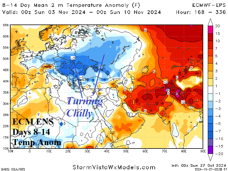
In Europe, an evolving sharp negative phase of the Scandinavia index in early November (Fig. 4) indicates an amplified upper ridge over Northwest Eurasia and a compensating trough into Southeast Europe. The upper trough brings stormy and much cooler weather to Europe to Southwest Russia in the medium range (Fig. 5-6).
The MJO shift across the equatorial Pacific through early November is supportive of hot and mostly dry weather in Australia. The ECM ENS maintains a prohibitive hot weather pattern in the latest 15-day outlook (Fig. 7) including widespread continental risk of >100F/38C daily maximum temperatures (Fig. 8-9). The hot weather pattern should end during the middle third of November.
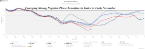
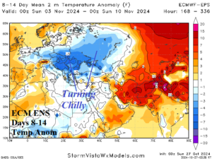
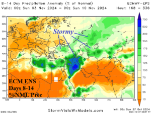
Fig. 4-6: The 15-day Scandinavia index outlook and 8-14-day temperature and precipitation amount forecast for Europe/Western Russia.
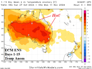
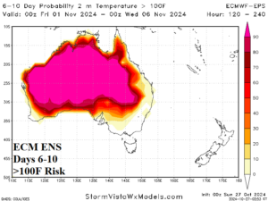
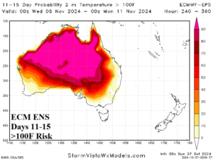
Fig. 7-9: ECM ENS 15-day temperature anomaly forecast across Australia and the >100F/38C risk areas for the medium range.

