Climate Research: The Summer 2024 North Atlantic Warm Hole and Climate Influence
07/15/2024, 5:47 am EDT
Ocean Temperature Big Contributor to Globe’s Hottest Days on Record
07/24/2024, 7:52 pm EDTExecutive Summary: As a review, a look at the July 1994 cold surge into Brazil is provided. The cold surge peaked July 10-11, 1994, in Brazil causing a widespread coffee freeze that destroyed 30% of the crop according to U.S. media reports at that time. The cold air mass was made severe by the presence of a deep upper trough centered on Uruguay. The proximity of the deep upper trough to Brazil caused the extreme cold. The second half of July 19914 shifted somewhat warmer. The first half of July 2024 was quite cold but not nearly as chilly as 1994 due to the offshore location of the driving low-pressure center. As a learning point, the core of the cold air generating trough over the South America landmass with proximity to Brazil is the ideal pattern to cause a hostile cold outbreak.
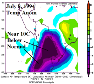
Fig. 1: An emerging cold air mass on July 8, 1994, across central South America.
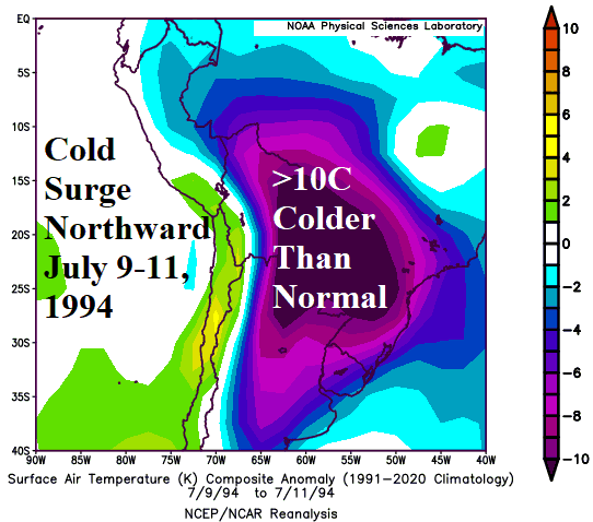
Discussion: On July 1, 1994, a chilly air mass emerged over Northwest Argentina. The air mass shifted across Northern Argentina with peak intensity of 5C below normal on July 3rd. During July 4-7, the cold air mass was stationary over Argentina with the northern extent touching Paraguay and Uruguay. On July 8th, the air mass intensified as departures from normal across most of Northern Argentina approached -10C (Fig. 1). The sudden chill was due to a relatively small but potent low-pressure trough centered on Uruguay (Fig. 2). The cold air mass surged into Brazil July 9-11 gaining intensity (Fig. 3). The coldest mornings across the Southern Brazil coffee areas were July 10-11. The chill was widespread across Brazil on July 12th but losing intensity. By July 14th, Argentina was warmer than normal, and the cool weather was across Eastern Brazil losing most intensity.
During the first half of July 2024, a cold pattern persisted across Argentina, Eastern Bolivia, Paraguay, Uruguay to far Southeast Brazil (Fig. 4). The strength of the cold anomaly was about half of the 1994 outbreak, not as cold and with less aerial coverage. The upper air pattern associated with the cold regime of the first half of July 2024 feature an elongated trough extending from a center well east-southeast of Uruguay (Fig. 5). The strength of the upper trough was about 2/3 of the 1994 episode although well offshore whereas the 1994 trough was intense over the east-central South America landmass.
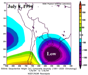
Fig. 2: The upper air pattern associated with the strengthening Northern Argentina cold air mass on July 8, 1994.
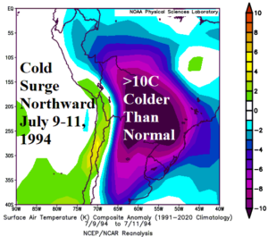
Fig. 3: The cold surge into Brazil featuring widespread <10C colder than normal anomalies for Southern Brazil.
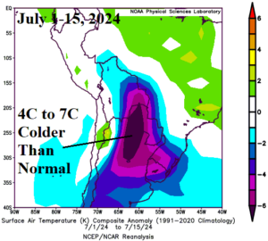
Fig. 4: The chilly pattern across central and south-central South America for the first half of July 2024.
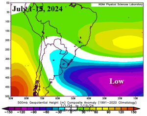
Fig. 5: The upper air pattern for the first half of July 2024 associated with the chill air mass across Argentina, Paraguay, Uruguay, and Southeast Brazil.

