07/24/2025, 7:21 am EDT
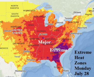
The hot weather is impressive through the weekend focused on the Ohio Valley today and Northeast/Mid-Atlantic tomorrow, but extreme alert-4 conditions for dangerous heat emerge Sunday and Monday (Fig. 2) in the Southeast U.S. On Tuesday and Wednesday of next week, extreme alert-4 conditions widen across the Southeast U.S. where this heatwave is most intense.


