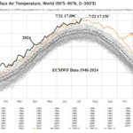
Ocean Temperature Big Contributor to Globe’s Hottest Days on Record
07/24/2024, 7:52 pm EDT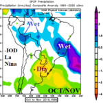
-IOD/ENSO Regimes across South America for OCT/NOV and DEC/JAN
08/09/2024, 4:15 pm EDT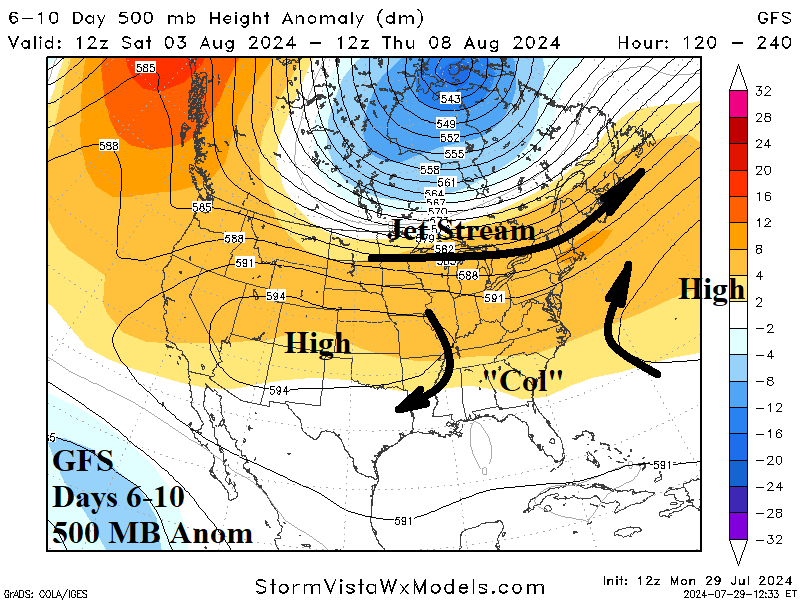
Highlight: What is a “col”?
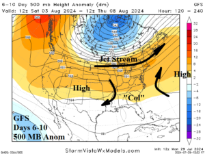
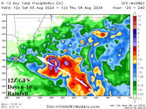
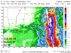
Fig. 1-3: The upper air pattern forecast by GFS for days 6-10 indicates a “col” located over Georgia and Florida. A “col” is an area of very light wind. The GFS and ECM develop a tropical system that slows down to produce heavy rain moving into the “col” region.
Discussion: An area of light and variable wind flow resting in-between high-pressure centers is known in meteorology as a “col”. When located in regions where tropical cyclones are tracking, storms slow down and sometime become stationary. Intensification occurs if tropical systems are offshore. If a tropical cyclone moves into a “col” along or just inland the coastline, stalled systems can wring-out excessive rainfall causing substantial flooding.
At midday, both the 12Z GFS and 12Z ECM indicate presence of a “col” over Northern Florida and Georgia (Fig. 1). Each model SLOWLY organizes and strengthens a tropical wave in the central North Atlantic tropical latitudes now, reaching either side of South Florida this weekend. The GFS takes a developing system toward coastal Alabama slowly while unloading substantial rainfall in the 6-10-day period (Fig. 2) likely to linger beyond day-10 as the system stalls due to the presence of the “col”. Meanwhile, ECM drifts a developing tropical system northward to the east of Florida and into the Carolina Coast during the 6-10-day period, also moving slowly due to weak steering currents associated with the “col” (Fig. 3).
The tropical wave in the central North Atlantic tropics appears weak now but is expected to drift west-northwest with a 50% chance of developing into a tropical cyclone later this week according to NOAA/NHC. If so, this system could bring an unusually long duration heavy rain to parts of the coastal Southeast States this weekend into early next week.