Explaining The Recent Spike in Negative Phase Indian Ocean Dipole
10/16/2024, 8:52 am EDT
A Sudden Spike in Negative Phase of the Indian Ocean Dipole
10/24/2024, 8:21 am EDT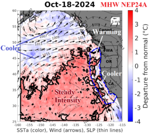
Fig. 1: The NOAA/California Current Integrated Ecosystem Assessment of the current marine heatwave (NEP24A) in the Northeast Pacific.
Discussion: Another hotter than normal summer and early autumn in California thanks in large part to the emergence of Marine Heat Wave NEP24A which started last April offshore and spread into the U.S. West Coast and intensified during the summer season (Fig. 1). As usual, the presence of the MHW helped amplify an upper-level high-pressure ridge to cause the hot summer. One fascinating aspect of MHW24A presence is the persistent and strengthening cool phase of the Pacific decadal oscillation (PDO), normally present when the Northeast Pacific Ocean surface is cooler than normal. The -PDO continues due to the comparably ridiculously warmer than normal waters of the northwest/north-central North Pacific (Fig. 2). The northwest to northeast Pacific oceanic sea surface temperature anomaly (SSTA) pattern is persistent and record strong so far in this decade (Fig. 3). By comparison, the Northeast Pacific SSTA is less warm than the Northwest Pacific justifying the -PDO index. Unfortunately, this new -PDO pattern is not representative of our historical understanding of -PNA climate regimes. According to the NOAA/California Current Integrated Ecosystem Assessment, MHW24A should continue but weaken in late 2024. The presence of MHW’s reaching the North America West Coast is normally associated with warm ENSO. NEP24A may be a partial explanation for the slow development of an anticipated La Nina 2024-25 and the likely weak character of cold ENSO heading into 2025.
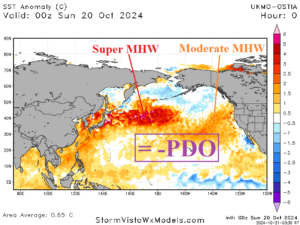
Fig. 2: The current -PDO is due to a less warm SSTA pattern in the Northeast Pacific when compared to the ridiculously warm SSTA in the Northwest Pacific.
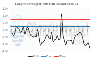
Fig. 3: The long duration and record strength negative cool phase of the Pacific decadal oscillation of the current decade.

