03/24/2025, 8:11 am EDT
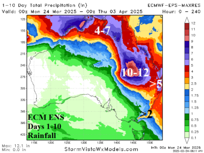
While 11-15-day forecasts are disagreeable on whether the heavy rain pattern fades in Northeast/East Australia, the 10-day forecasts are confident. The ECM ENS indicates up to 12 inches of rain for Southwest Queensland in their latest 10-day outlook.
