05/27/2025, 5:28 am EDT

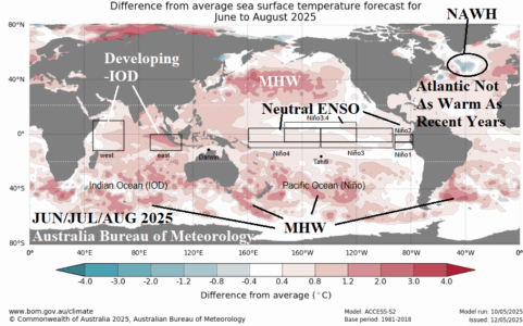
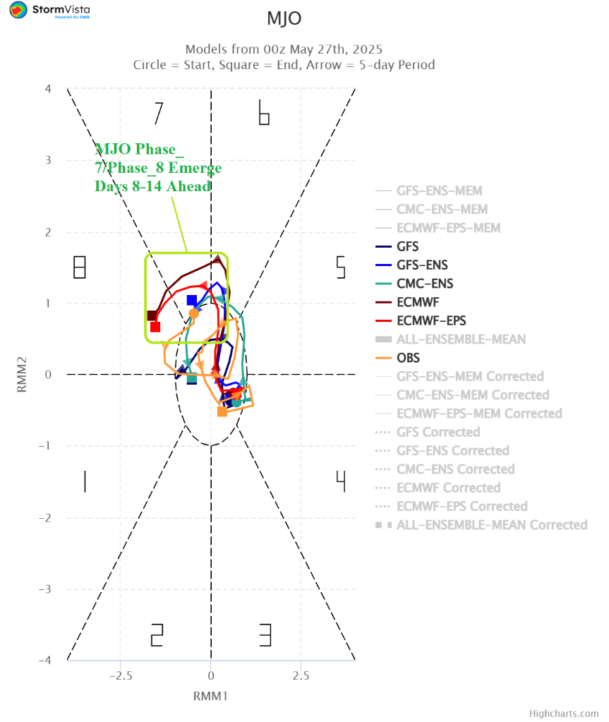
Operational models are indicating increased risk of anomalous wet weather across much of the Southern U.S. and Brazil during early-to-middle June. Support for the wetter tropical/subtropical weather is increasing as forecasts of the convection phase of the Madden Julian oscillation (MJO) are trending stronger east of the Dateline in the tropics to the American longitudes (phase_7 and phase_8).

