01/30/2025, 5:44 am EST
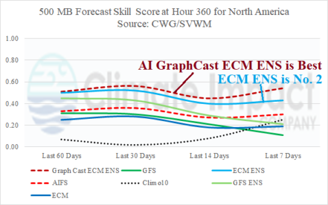
The preferred 360-hour 500 MB anomaly forecast by AI Graph Cast ECM ENS indicates a cold longwave trough (with arctic air) across the West U.S. while an East U.S. ridge is shifting offshore and Northwest Eurasia is beneath an amplified ridge.