10/26/2024, 10:19 am EDT
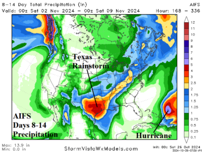
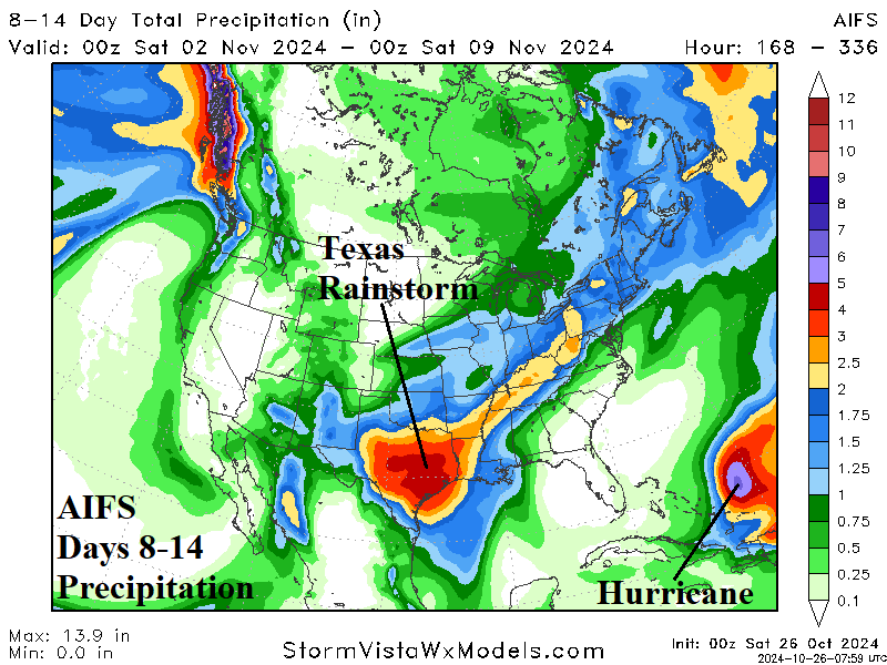
After a series of GFS model runs indicating an East U.S. Coast tropical cyclone risk in early November, possibly disrupting voting day, forecast models are now in agreement the tropical system is likely to stay away from U.S. Atlantic Seaboard. The new forecast creates another problem, a heavy rainfall episode in early November centered on Texas and the southern Great Plains.