03/02/2025, 10:52 am EST
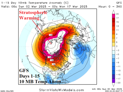
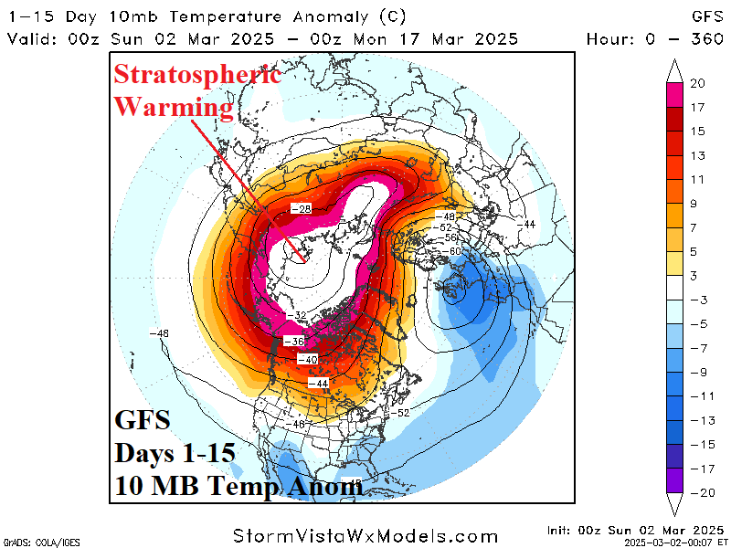
Weekend forecasts maintain the stratospheric warming episode unfolding on the Eurasian side of the North Pole in the short-term and gradually extending across the polar region in the 15-day outlook. The Graph Cast 500 MB anomaly forecast indicates a polar vortex pattern forms on the Northeast Canada Coast with moderate intensity troughs located in Alaska and the West U.S.