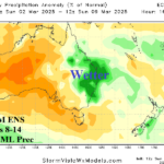
Dry This Week in Australia; Tropical Cyclone Threat Queensland Early Next Week
02/23/2025, 2:13 pm EST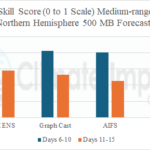
Skill Scores Forecast Models Including AIGS and Graph Cast
02/26/2025, 1:57 pm EST
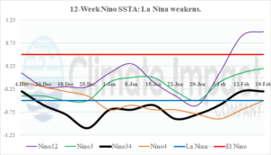
Fig. 1: Sudden warming in the Nino SSTA regions indicates that oceanic La Nina has at least temporarily ended.
Discussion: During recent weeks, the convection phase of the Madden Julian oscillation (MJO) settled in the eastern equatorial Pacific to the longitudes of the Americas. Consequently, trade winds have eased across the eastern equatorial Pacific Ocean preventing the upwelling of cooler waters to sustain La Nina. The Nino SSTA regions have warmed significantly. Most apparent is the evolution of a warm El Nino-like SSTA in the Nino12 region off the northwest coast of South America. The Nino34 SSTA region, where ENSO phase is monitored, has warmed to neutral phase at -0.30C during the past 2 weeks. To reverse the warming trend in the eastern equatorial Pacific and allow weak oceanic La Nina to return, the MJO will need to shift to the Indian Ocean tropics with intensity. Currently, all models agree on an eastward shift of the MJO to tropical Africa with some weakening.
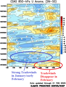
Fig. 2: Tradewinds to upwell cool subsurface water in the eastern equatorial Pacific to sustain La Nina ended during the past 2 weeks (yellow).
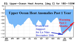
Fig. 3: Upper ocean heat in the eastern equatorial Pacific observed a cool peak in December when oceanic La Nina onset was announced by NOAA. Since that time, the cool peak has steadily weakened.