News
02/07/2025, 9:15 am EST

Upper Air Pattern Changes: Wetter Argentina

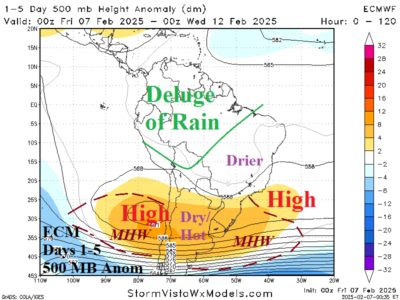
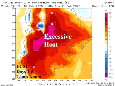
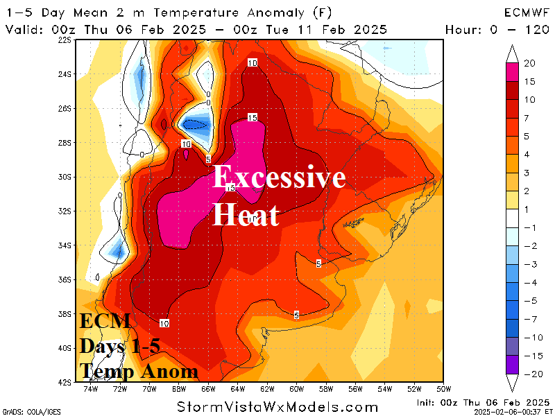
This week, strong subtropical high pressure stretching across mid-continent from marine heat waves either side of South Americ render extreme heat from Argentina to Southeast Brazil. However, latest forecasts split the subtropical ridge allowing weak low pressure to form over Bolivia which lifts tropical rains from northwest continent southeastward into Argentina during the medium range.
02/06/2025, 4:01 am EST

Excessive Heat/Dryness Warning Argentina!

A titanic high-pressure area extending eastward from a marine heat wave west of South America causes extreme heat over the next 5-7 days in Argentina coupled with dryness likely to accelerate drought conditions into late summer.
02/04/2025, 5:32 am EST

Impactful Winter Storms Ahead for the Central and Northeast U.S.

Although extended range U.S. forecasts trend milder overnight, there is a caveat for the Midwest to Northeast U.S. Corridor. During next week’s cold, the North and East U.S. storm track turns snowy. Consequently, as the U.S. enters the extended range, snow on the ground could allow chilly air to linger, especially in the Northeast.