03/19/2025, 8:37 am EDT
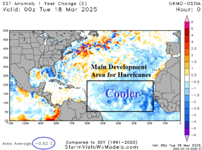
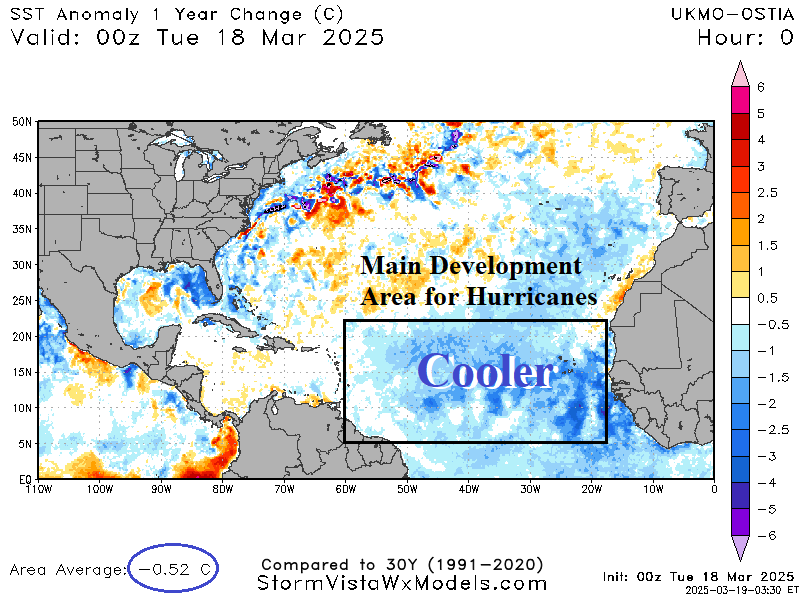
The North Atlantic basin remains warmer than normal but not as warm as one year ago. The main development region (MDR) has cooled to near normal. A marine heatwave in the subtropical North Atlantic remains but has weakened while very warm SSTA continue in the Caribbean Sea and parts of the Gulf of Mexico.
