07/30/2025, 1:28 pm EDT
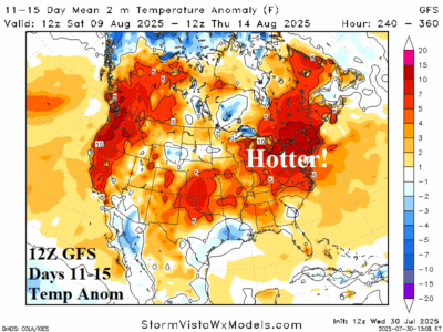
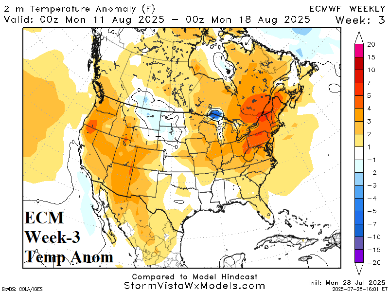
The 12Z GFS is hot in the Southwest during the 6-10-day period and trending warmer from the eastern Canadian Prairies to Quebec. In the 11-15-day period, the 12Z GFS explodes hotter into the Northeast U.S. causing 106 CDD for Aug. 8-14 which would easily exceed the current week.
