08/07/2025, 9:08 am EDT
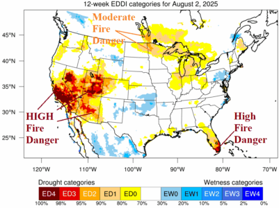
The 12-week Evaporative Drought Demand Index (EDDI) reveals U.S. areas most susceptible to fire risk for late meteorological summer/early autumn. The highest alert, ED3/ED4 is spread across central and southern California, much of the Great Basin, and Arizona.
