01/08/2025, 11:35 am EST
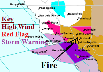
The meteorology involved with the fire features a low-pressure area over the northern Baja California Peninsula and a high-pressure area over the Great Basin. In-between the 2 pressure systems, easterly (Santa Ana) wind has spread across Southern California with periods of hurricane force gusts. A plethora of high wind and red flag warnings affect Southern California.

