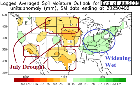
As mid-summer arrives, NCEP/CAS projects widening wet soils in the East while drought risk is highest in the Great Plains. A wet Southwest U.S. Monsoon is expected and weakens parts of the Southwest U.S. drought zone.
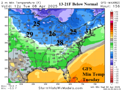
After this week's extreme rainfall and flooding, the following cold remains impressive with GFS indicating morning low temperatures close to 20F below normal next TUE, WED, and THU morning from the Midwest to Northeast U.S.
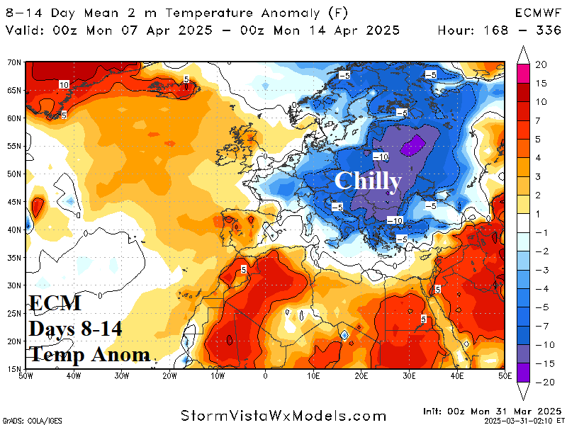
Expect unseasonably chilly air to emerge in the 8-14-day period with coolest anomalies across East Europe and West Russia. Threshold temperatures include <32F across much of central and east portions of Europe and west sections of Russia in the 6-10-day period.
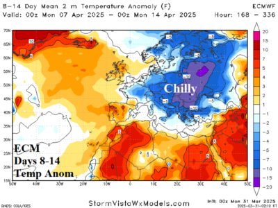
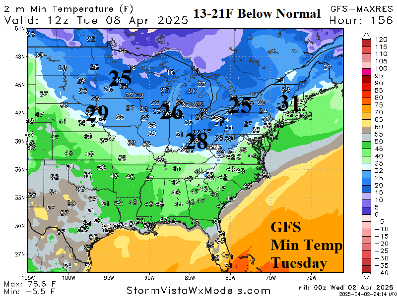
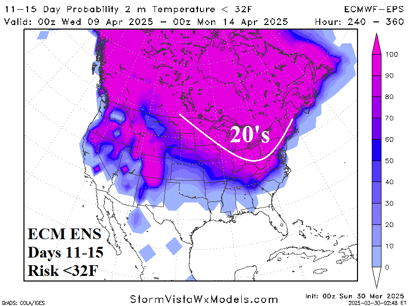
Of added importance to the forecast is cold weather. Focused primarily on the 8-14-day period, a chilly early April is indicated especially for the Eastern Corn Belt. The risk of <32F extends to the Tennessee Valley and across the Midwest U.S. with widespread 20’s reaching the Ohio Valley in the 11-15-day period.
