10/01/2025, 5:54 am EDT

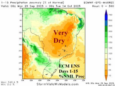
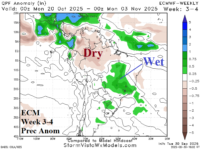
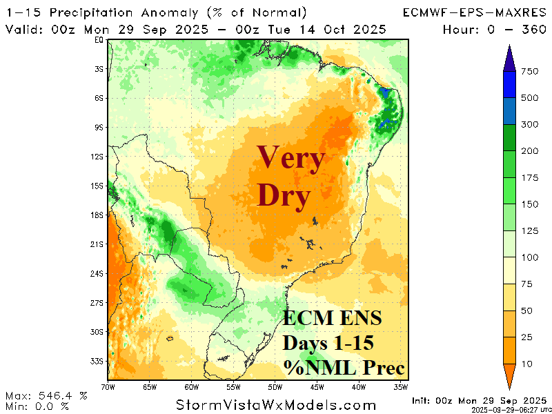
Climate forecasts indicate wetter weather ahead for the Brazil drought area in Q4/2025. The ECM week 3-4 forecast projects a wet anomaly across the drought area. The latest Madden Julian oscillation (MJO) forecast indicates an emerging moderate-strength phase_8 which supports a wetter climate shift for South America, specifically Brazil, by week-3.
