11/19/2025, 4:41 am EST
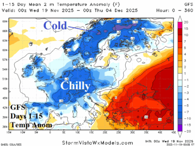
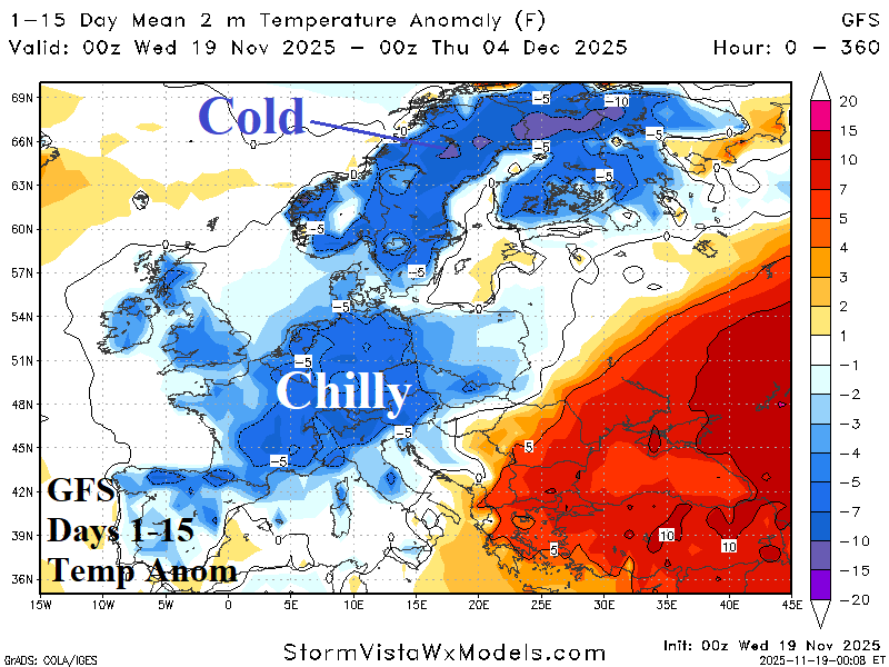
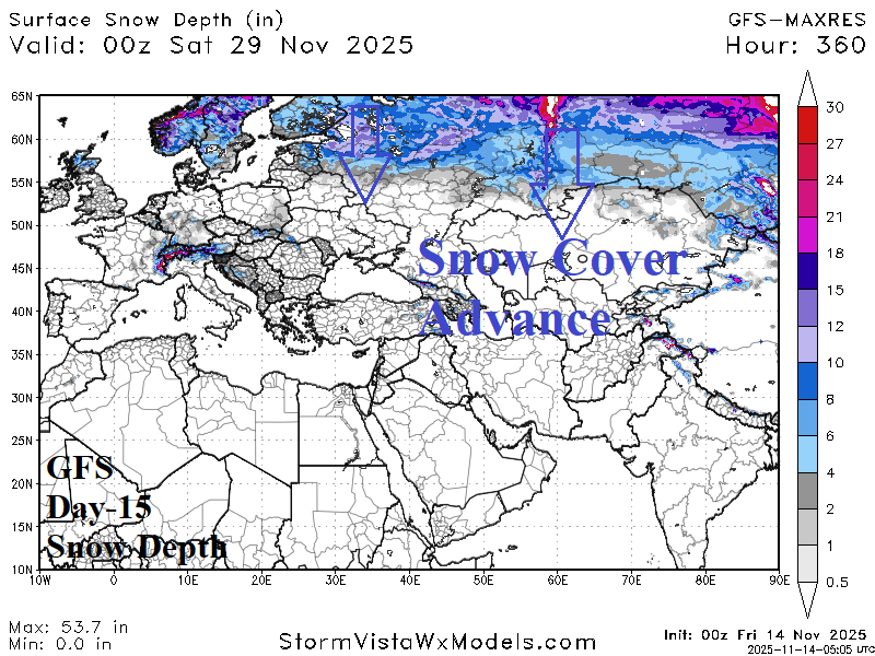
According to GFS, a semi-permanent upper-level longwave low-pressure trough anchors over Europe during the remainder of November causing a chilly pattern to develop also featuring heavy precipitation. At night, widespread 20’s (F) cover Europe into early December with teens (F) across Scandinavia and Northwest Russia. <32F reaches the British Isles.

