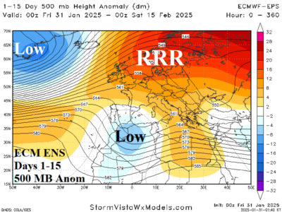
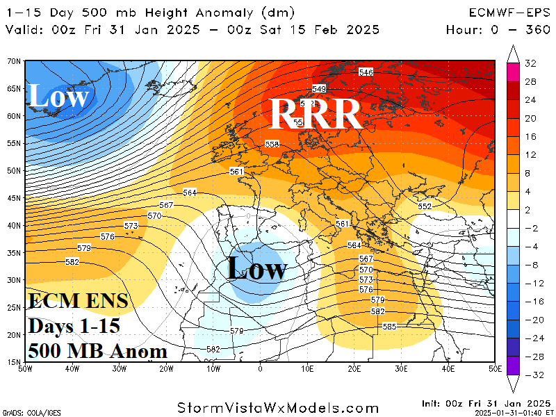
The persistent upper ridge has produced a dry climate over parts of Eastern Europe, the Black Sea region, and Western Russia leading to ongoing and strengthening drought in key agricultural areas.
The preferred 360-hour 500 MB anomaly forecast by AI Graph Cast ECM ENS indicates a cold longwave trough (with arctic air) across the West U.S. while an East U.S. ridge is shifting offshore and Northwest Eurasia is beneath an amplified ridge.
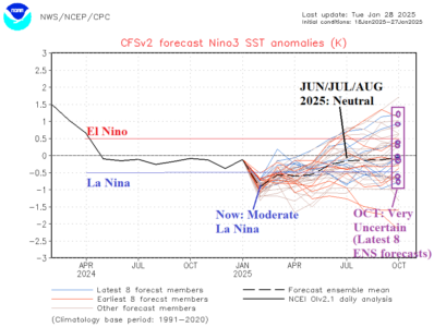
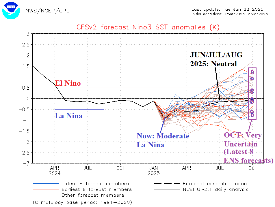
The latest Nino34 SSTA forecasts from the CFS V2 model confidently project moderate La Nina to finish northern hemisphere meteorological winter followed by weakening to neutral ENSO mid-year. The latest 8 ensemble members of CFS V2 forecast indicate a wide variety of ENSO phase possibilities by OCT-25 which identifies a low confidence projection.
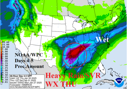
On Wednesday, heavy rain with severe thunderstorms will develop across Texas. By Thursday, excessive rain including a severe weather threat affects the Mid-south U.S. NOAA/WPC indicates potential for several (or more) inches of rain with flood risk.
