12/24/2025, 7:41 am EST
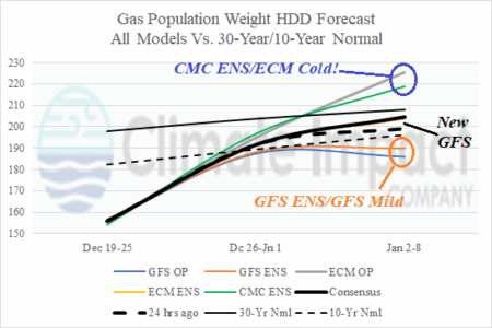
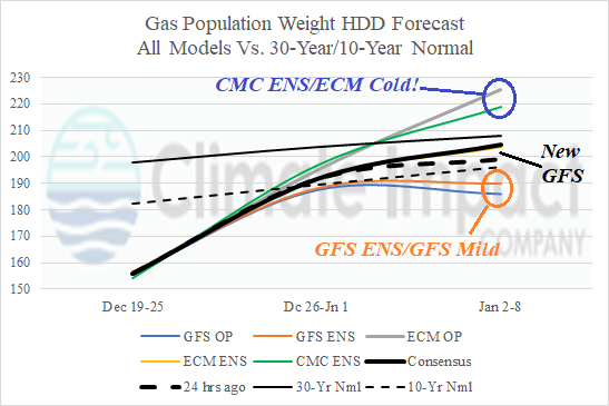
Utilizing all operational models, forecasts are agreeable to the decelerating warm pattern to near the 10-year normal for next week. In the Jan. 2-8 period, forecast models vary widely from a milder national scenario (GFS ENS/GFS) to much colder than normal (CMC ENS/ECM). The just released GFS was near the overnight consensus.