12/19/2025, 5:46 am EST
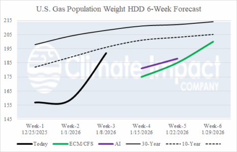
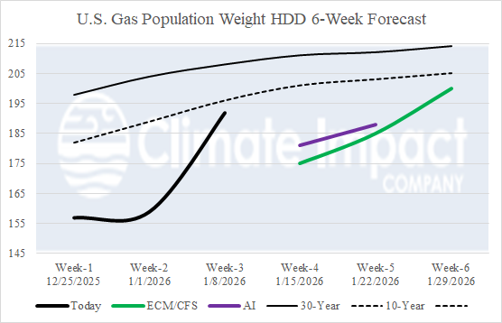
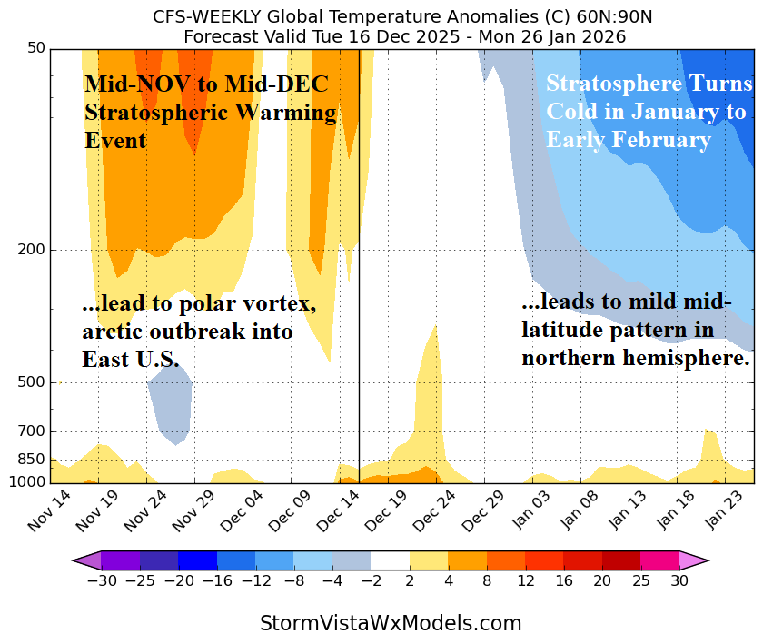
The U.S. gas population weight HDD forecast for weeks 4-6 ahead continue to favor a mild climate, especially in the East. The consensus of operational models are trending colder, near the 10-year normal, for the week ending January 8th. So…operational models are pointing toward a colder regime whereas “weeklies” ignore that shift to maintain the warmth. Two AI models are cold in the 3-4-week period.
