Using Wet PDSI Analogs to Predict Winter Temperature and Following Spring Precipitation
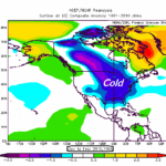
11/10/2019, 7:48 pm ESTThe Potent Influence and Implications of Warm SSTA on Climate
03/27/2020, 5:08 am EDTDiscussion: Last February the U.S. Palmer Drought Severity Index (PDSI) was extremely wet in the Midwest and East U.S. (Fig. 1). The PDSI is in response to long-term climate and therefore becomes an effective short-term predictor of precipitation. Implied by last year’s wet extremes was a following wetter than normal spring possibly excessive wet. MAR/APR/MAY 2019 rainfall was historic (Fig. 2) and centered on the South-central U.S. leading to a massive flooding event including much farmland and nearly all rivers in this region.
The February soil moisture ranking features similar characteristics to last year (Fig. 3). Historic wet soils are indicated across the North-central and Mid-South U.S. The climate memory causing these conditions is likely to continue during spring 2020. The best estimate as to where the spring rains will set-up can only be determined by analogs as dynamic models (ECMWF and NCEP CFS V2 “monthlies”) are not reliable and currently in disagreement.
The analogs are chosen from the past 30 years ONLY due to the ocean surface warming unique to this period. The analog years are 2019, 2010, 2009, 1997 and 1994. Keep in mind the current soil moisture is historic and the analogs chosen are based on approximately similar (soil moisture) conditions using the month of March. The analog indicates meteorological spring wet risk is greatest across the Mid-South U.S. and extends to Texas, the Tennessee Valley and throughout the Gulf States (Fig. 4). Note that the western Corn Belt is dry.


Fig. 1-2: The Palmer Drought Severity Index for February 2019 identifies extreme wet soils heading into meteorological spring last year. The memory of the climate producing the wet soils continued during last spring with heavy rains across the Great Plains and Mid-South U.S.


Fig. 3-4: The current U.S. soil moisture historical ranking identifies the North-Central and Mid-South/Southeast as having the wettest soil moisture on record. Analog years when large regions of wet soil moisture across the Central and into the East were present during March are averaged to project meteorological spring most likely anomalous rainfall areas.
Conclusions: Current soil moisture conditions across the Central and East U.S. are similar to last year at this time…wettest on record. Soil moisture is the result of the long-term climate therefore short-term climate predictions can use past precipitation patterns causing similarly wet soils to project the season ahead anomalous precipitation. The analog years chosen approximate the very wet soil conditions of late winter 2020 and are chosen from just the past 30 years when oceans began to warm (compared to long-term average). The analog years are 2019, 2010, 2009, 1997 and 1994. The more recent analogs may be more reliable due to their occurrence during the warmer global ocean period. The analog forecast (Fig. 5) projects major flooding in the Mid-South U.S. while the North-central/Midwest flooding is not nearly as bad as last year primarily due to the spring 2020 wet belt located farther to the south. The California drought intensifies.

Fig. 5: Based on the analog cited and current soil moisture conditions the Climate Impact Company U.S. Spring Flood and Drought Outlook is indicated.