Tropical Cyclone Threatens Gulf of Mexico Later This Week
11/03/2024, 1:33 pm ESTHighlight: Madden Julian oscillation inspires heavy Central U.S. rains and a rare November Gulf of Mexico hurricane.

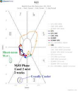
Fig. 1: The 15-day MJO forecast utilizing all models.
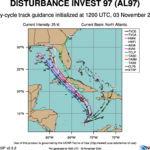
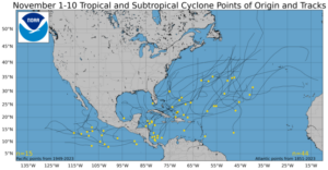
Discussion: The Madden Julian oscillation is shifting to the east (phase_1 to phase_2), across the tropical longitudes of the Americas and eventually through tropical Africa in 2 weeks (Fig. 1). Many high impact climate events are SUPPOSED to happen with this regime. Some of them WILL happen. There is strong support for the heavy rainfall event in the Central/East-central U.S. through the next 7-10 days as MJO causes the tropics to be involved increasing potential rainfall. Additionally, the MJO inspires a rare November hurricane (Fig. 2) in the Gulf of Mexico. The MJO also inspires ongoing heavy rains in Brazil. The shift of the MJO eastward from the Atlantic to the western Indian Ocean is forecast for mid-month. Normally, the eastward shift to this location forces a cooler change in the U.S. not currently indicated by forecast models. Additionally, a drier pattern change in South America as MJO shifts to the Indian Ocean is (also) not indicated in 11-15-day forecasts. Forecasts beyond 10 days and into week-3 are made with low confidence right now.

Fig. 2: Nov. 1-10 historical tropical cyclone tracks in the North Atlantic basin.

