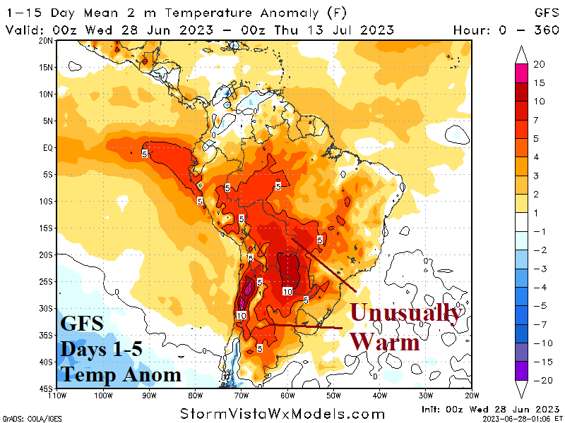
Early Winter Heat and Dryness in South America
06/28/2023, 5:30 am EDT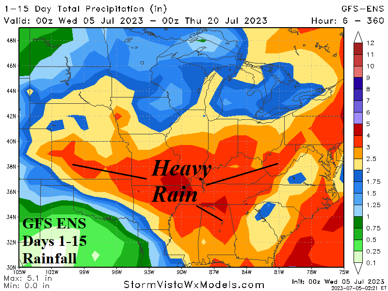
Wet Midwest Pattern Shifts Southward Into Mid-July
07/05/2023, 5:41 am EDT
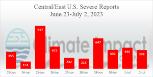
Fig. 1: The past 9 days have brought 4,234 severe weather reports to the Central and East U.S.
Discussion: The June 23-July 2, 2023, severe weather pattern across the Central and East U.S. is immense with 4,234 reports during that time including 917 reports on June 25 and 647 reports on June 29 (Fig. 1). During that time rainfall has piled to 5-10 in. across parts of southwest Illinois to eastern Missouri to western Kentucky. The much-feared Midwest U.S. 2023 drought has eased considerably if not ended in some locations. The relentless Central U.S. severe weather pattern continues this week with a new batch arriving in the northern Great Plains today and gradually shifting south and east eventually reaching Texas and Oklahoma to the Ohio Valley (Fig. 2). Next week, ECM maintains northwest Great Plains to Mid-south/Midwest thunderstorms (Fig. 3).
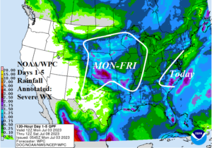
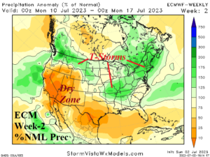
Fig. 2-3: Today’s NOAA/WPC 5-day rainfall amount forecast and annotated region of severe weather during this time plus the ECM week-2 U.S. percent of rainfall forecast.
In the 8-14-day period, the heavy rain/severe weather pattern continues shifting south and stretching from the Mid-south U.S. to the Carolinas (Fig. 7). The NCEP CFS V2 precipitation anomaly outlook for July maintains a wet pattern across parts of the U.S. Corn Belt and into the Northeast U.S. Corridor (Fig. 8).
West/Northwest Europe trend wetter in the latest 15-day outlook with GFS indicating up to 2-5 in. of rain (Fig. 4). GFS also indicates a heat spike mostly focused on South-central Europe in the 8-14-day period (Fig. 5).
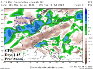
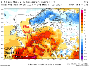
Fig. 4-5: GFS 15-day rainfall anomaly forecast for Europe and the 8-14-day temperature anomaly outlook (by GFS).
Elsewhere, a wet pattern in Australia centered on Queensland this week abates and the remainder of the continent is mostly dry through the next 15 days. In India so far, the (wet) monsoon has soaked western nation reaching the wheat growing areas in central sections. Dryness is dominant across eastern sections of India. In China, southern crop areas recently endured another heavy rainfall/flash flood episode while across central and northern crop areas hot weather and drought continue to develop.