Negative Pacific North America Index COULD Bring Great Plains Rain
10/21/2024, 6:11 am EDT
GFS Maintains Early November Tropical Cyclone for Florida/U.S. East Coast
10/24/2024, 9:31 am EDT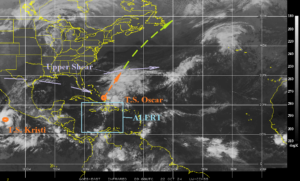
Fig. 1: The morning weather satellite view of the North Atlantic basin.
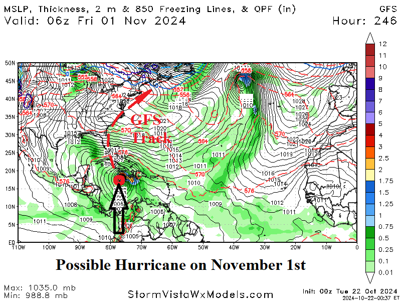
Discussion: Tropical Storm Oscar is undergoing transition into an extra-tropical storm drifting north-to-northeastward. Despite losing tropical characteristics, Oscar will travel northeastward as a powerful storm late this week with the back edge affecting Nova Scotia to Newfoundland. An ALERT for tropical cyclone development in the Caribbean Sea remains valid for next week. The last two GFS model runs develop a Northern Caribbean Sea hurricane which travels toward Florida and possibly the U.S. East Coast in early November. The North Atlantic SSTA pattern has cooled to near normal in much of the Gulf of Mexico and off the East Coast. However, much warmer than normal SSTA remain in place across the Caribbean Sea to east of the Bahamas.
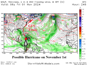
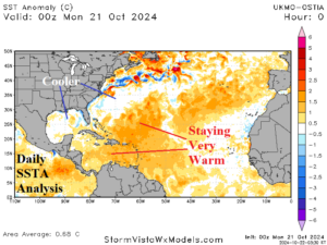
Fig. 2-3: GFS develops a Northern Caribbean Sea hurricane on Nov. 1st and the SSTA remain much warmer than normal in the Caribbean Sea.

