An Update on Australian Drought
11/29/2019, 8:19 am EST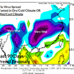
Climate & COVID-19
03/01/2020, 3:15 pm ESTAn emerging Madden Julian oscillation…influences on climate next 2 weeks
Mostly dry Great Plains
Argentina hot and dry late summer regime strengthens
Heavy rains north and east Australia
Southeast Asia gains rainfall; flooding rains in China


Fig. 1-2: An emerging Madden Julian oscillation the next 2 weeks…the prevailing influences on U.S. and global climate identified.
MJO discussion: When ENSO is weak or neutral the Madden Julian oscillation tends to be active. During this regime the MJO has a tendency to be most active where equatorial waters are warmest. MJO events are linked to almost all U.S. springtime heavy rain episodes and extreme dry or wet climate in the subtropics. Therefore tracking the MJO, when active and intense is essential to the agriculture markets. Over the next 2 weeks all forecast models indicate emerging moderate intensity of the MJO initially located in Maritime Continent and (interestingly) backing toward the eastern equatorial Indian Ocean (Fig. 1-2).
Historically, during March MJO phase_5, phase_4 (Maritime Continent) and phase_3 (eastern Indian Ocean) the influence on U.S. climate very dry across the western U.S., mostly dry in the Great Plains and supports storm tracks (not very intense) mostly in the Mid-South U.S. The climatology for temperature regimes is warm for most of the U.S. in phase_4 flipping cold in phase_3.
So what do the models reveal over the next 15 days in the U.S? As indicated by MJO support the next 10 days are (nationally) warm with cold introduced in the 11-15 day period above to penetrate the Northwest U.S. while the East and South are likely still warm (Fig. 3). The precipitation pattern indicates wet risk is in the South U.S. and (due to MJO influence) may be wetter than indicated in the Mid-South States (Fig. 4). North of the southern wet weather most of the U.S. is dry or lacking significant storms. Note the dryness for most of the Great Plains.


Fig. 3-4: An emerging Madden Julian oscillation the next 2 weeks…the prevailing influences on U.S. and global climate identified.
Internationally, the emerging MJO supports dryness in South America and a wet climate in Australia backing into Southeast Asia with time. Do operational models convey this climate pattern?
The South America forecast is certainly drier than normal with emphasis on Argentina, Paraguay and southwest Brazil (Fig. 5). The eastern Brazil wet forecast is likely overdone based on the MJO climate influence. Not surprisingly, the upper high pressure ridge inspired by the MJO influence and promoting a dry climate also causes important anomalous heat in Argentina (Fig. 6). A dry climate coupled with anomalous heat leads to rapid drying of soils.


Fig. 5-6: The Canadian Ensemble identifies a mostly dry climate across South America the next 15 days while anomalous heat is emphasized across Argentina in the GFS OP 15-day temperature anomaly forecast.
In Australia presence of the MJO to the north soaking Indonesia extends its wet influence to north and east portions of the continent featuring excessive amount (Fig. 7). The wet pattern backs into Southeast Asia where rare shower activity reaches the Thailand drought (Fig. 8). Note the enhancement of precipitation across China where excessive amount will cause flash flooding.


Fig. 7-8: The GFS ENS 15-day rainfall forecast across Australia and ECM ENS 15-day rainfall forecast across Southeast Asia.