NOAA 2020 North Atlantic Hurricane Outlook
05/21/2020, 12:00 pm EDT
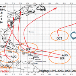
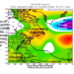
Explaining Recent Tendency for Stalled U.S. Coastal Tropical Cyclones
05/31/2020, 2:19 pm EDTMost (not all) ENSO phase forecast models indicate La Nina is likely to form mid-to-late quarter 3 of 2020. Interestingly, the evolution of cold ENSO occurs simultaneously with developing negative Indian Ocean Dipole (-IOD). Indicated is a much warmer than normal ocean surface in the far eastern Indian Ocean/western Pacific Ocean (32C) compared to the cool equatorial East Pacific (26C). The temperature differential is 6C about twice normal. The (very) strong thermal gradient from east-to-west across the equatorial Pacific implies strong trade winds in the east/central equatorial Pacific which upwell cool waters that strengthen La Nina. Given this increasingly expected dynamic La Nina could be stronger and last longer (into 2021).
