Brazil and (More) Europe Rains Ahead!
03/31/2024, 10:36 am EDTThe Record Rains for Northern Australia in March
04/03/2024, 5:33 am EDT 


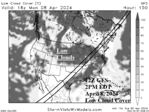
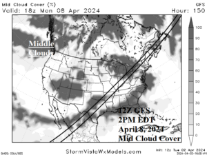
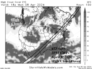
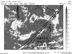
Fig. 1-4: The 12Z GFS low, middle, high, and TOTAL cloud cover forecast for 2PM EDT on Monday, April 8, 2024.
Discussion: The 12Z GFS projects an area of showers stretching from the Texas Coast to Louisiana and northeastward to the central Appalachians and westward across the entire Ohio Valley next Monday afternoon around 2PM EDT. Low clouds (cumulus/nimbostratus) associated with rain are shifting east of the eclipse track from Texas to Arkansas but hang tough across the Ohio Valley (Fig. 1). This type of cloud will be most opaque and cause a sharp weakened view of the eclipse. Middle clouds (altostratus/altocumulus) are widespread across Texas but will dissipate Arkansas to Indiana (Fig. 2). Middle clouds are widespread across the Great Lakes region. Middle clouds are semi-opaque. High clouds (cirrus/cirrostratus) are widespread across Texas to the southeast Great Plains and Great Lakes to the northern Mid-Atlantic region (Fig. 3). Cirrus is generally the least opaque cloud. The TOTAL cloud cover forecast features at least some cloudiness along the eclipse track in the U.S. except for northern New England where best viewing is projected (Fig. 4). The forecast trend is a less potent storm shifted east of Texas while cloudiness in the Great Lakes region has increased.
